by Madeline Roth, East Carolina University

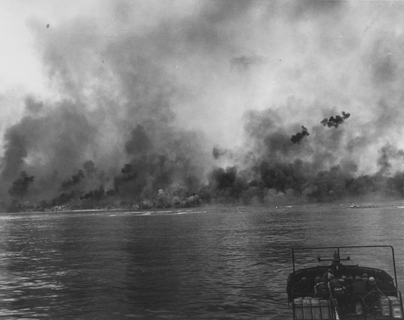
D-Day Landing on the invasion beaches by American forces. Pre-invasion bombardment contributed to the confusion and chaos of the battle in firsthand accounts. Source: National Archives Photograph 80-G-59497. Download larger version (jpg, 530 KB).
At Peleliu, both Japanese and American forces relied on the island’s terrain in their decision making. The physical landscape—from the cave systems to ridgelines—played a vital role in the movement of troops and resources across the island. Many of these terrestrial terrain features have been well documented by archaeologists, leading to an in-depth understanding of the battle on the ground. Yet, for those stationed in the waters surrounding the island, there has been little research addressing their experiences. For this project, the team has been collecting reports and statements from marines, sailors, and aviators to understand significant marine and terrestrial terrain features which aided in the initial amphibious assault.
Many of the narratives collected so far offer insight into individuals’ experiences during the battle. While informative, these firsthand accounts can be narrow in focus due to the high stress and tension of warfare. Furthermore, as some of these interviews were conducted decades after the battle, details can be lost or fuzzy. As the project aims to reconstruct the events of the marine landing from firsthand experiences, it can be difficult to understand the larger scope of the battle when personal statements are vague, contradictory, or even missing information. To understand (and work through) these discrepancies, the team will be using KOCOA military terrain analysis.
KOCOA is an acronym used to categorize terrain features identified in primary battle accounts into Key terrain, Observation and fields of fire, Cover and concealment, Obstacles, and Avenues of approach/withdrawal. While analyzing primary and secondary sources, researchers have been recording any significant terrain features and have assigned them to a corresponding attribute category. When the fieldwork on Peleliu begins, archaeologists will visit the locations of known KOCOA features at the invasion beaches to document any structure or artifacts present.
Following the fieldwork, the team will begin analyzing the documented sites and their relationships. As every terrain feature has associated geographic coordinates, features of the same category can be mapped together to show large-scale concepts such as defense strategies, marine obstacles, and strongholds. The final product is a series of maps that tie individual experiences to the larger battlespace.

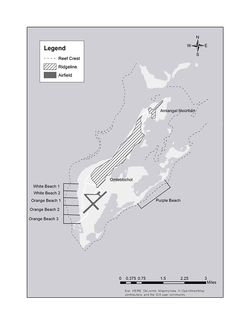
Some of the initial KOCOA features identified in primary accounts including the landing beaches, reef, and extensive ridgelines. Image courtesy of Madeline Roth, East Carolina University. Download larger version (jpg, 1.0 MB).
Identification of KOCOA features in the landscape and seascape today helps researchers understand individuals' battle experiences and the role terrain features played in the amphibious invasion. As these features may be associated with archaeological sites, a better understanding of their significance to the battle will help preserve and protect archaeological resources for future generations.