
June 22-30, 2017

A 2D photomosaic showing the profile view from one side of Norman’s remains. The vessel is 296 feet long and looms large off the lake bottom. Image courtesy of NOAA, Thunder Bay National Marine Sanctuary. Download larger version (jpg, 692 KB).
Dr. Guy Meadows, Jamey Anderson, Chris Pinnow: Great Lakes Research Center, Michigan Technological University
John Bright, Stephanie Gandulla, Sarah Waters, Philip Hartmeyer: Thunder Bay National Marine Sanctuary
Wayne Lusardi: State of Michigan
Deepwater shipwreck sites off Presque Isle in Thunder Bay National Marine Sanctuary’s expanded area.
This Autonomous Underwater Vehicle (AUV) survey system was provided by the Great Lakes Research Center at Michigan Technological University:
NOAA R5002, R/V Storm. Travis Smith (Captain).
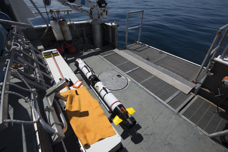
MTU’s Iver3 AUV on the back deck of R/V Storm following survey mission. The vehicle was launched and recovered from the vessel’s retractable tailgate and is shown transferring data to a portable drive for immediate review by researchers. The ability to review the sonar data in real time was extremely useful for making adjustments to mission planning parameters used in subsequent survey runs. Image courtesy of NOAA, Thunder Bay National Marine Sanctuary. Download larger version (jpg, 3.8 MB).
Hundreds of feet below the surface of Lake Huron lies a gargantuan steel ship: the bulk carrier Norman. Built in Cleveland at the Globe Iron Works shipyard in 1890, Norman sank just five years later following a collision with Canadian steamer Jack. The large freighter, broken and resting slightly on its port side, has remained nearly perfectly preserved on the lake floor ever since.
Sitting in 200 feet of water, however, the vessel is difficult to access. Divers have to use advanced, ‘technical’ diving procedures and equipment to spend even short periods of time at the archaeological site. Remotely operated vehicles (ROVs) would require hours of filming to capture the entire vessel from bow to stern. Sonar surveys can capture wide areas of lake floor very quickly, but are often of insufficient resolution to show all the details in something as complex as a vessel like Norman. To capture the greatest detail possible, a high-resolution sonar needs to scan very close to a given object; with Norman resting 200 feet underwater, getting close can be a big challenge.
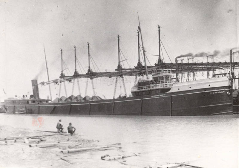
Historical image of Norman at a loading dock, profile of the starboard side of the freighter. Image courtesy of the Great Lakes Maritime Collection of the Alpena County George N. Fletcher Public Library. Download larger version (jpg, 1.2 MB).
There is, however, a technological solution to the challenge of getting a powerful sonar close enough to scan a large historic vessel in deep water: Autonomous Underwater Vehicles, or AUVs. Similar to an underwater drone, an AUV is able to navigate and collect information without being mounted or tethered to anything at the surface. Shaped like a small, streamlined torpedo, an AUV combines a propulsion system, navigation system, power supply, and instrumentation package within a hydrodynamic hull. It is essentially a self-contained underwater robot.
A number of instruments work in tandem to keep the vehicle properly orientated while underwater and out of the range of GPS signals. The navigation system uses GPS at the surface and dead reckoning on the bottom as ascertained through several integrated devices. A doppler velocity log (DVL) points downward from the vehicle’s underside to sense the bottom to help determine speed and altitude. An inertial measurement system (IMU) senses the pitch, roll, and yaw of the vehicle to help it drive straight and level. A compass helps determine direction, and a depth sensor measures distance from the water’s surface. As the vehicle navigates, the survey instrumentation cycles on and off to scan a programmed target area. These files are saved and stored within the AUV and must be retrieved once the vehicle is back on the surface, following a completed mission.
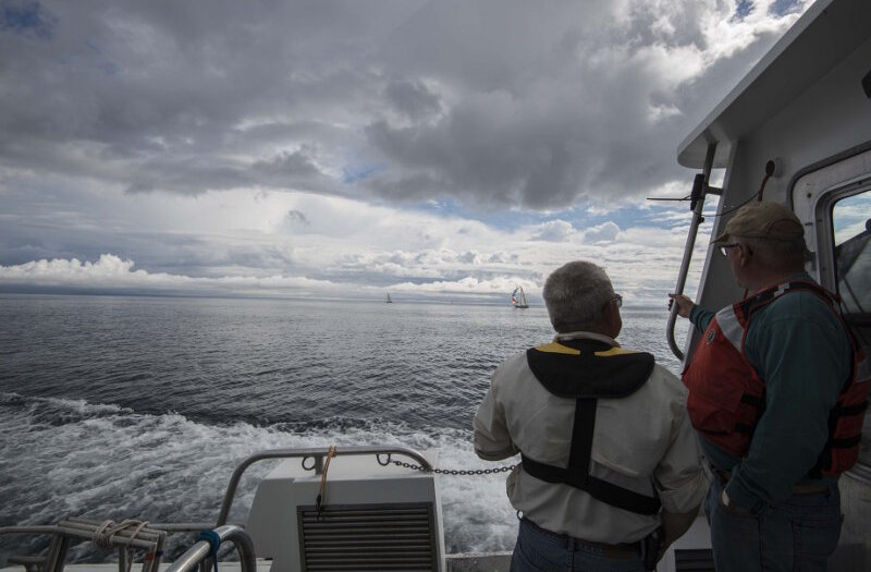
MTU’s Dr. Guy Meadows and Michael Beaulac, from the State of Michigan’s Office of the Great Lakes, look out over the waters off Presque Isle as R/V Storm transits to the survey area. Image courtesy of Thunder Bay National Marine Sanctuary/NOAA. Download larger version (jpg, 3.7 MB).
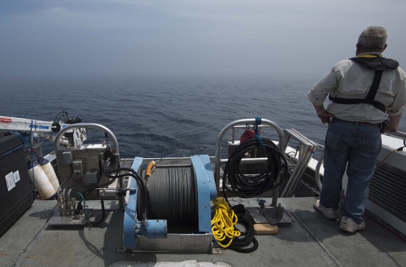
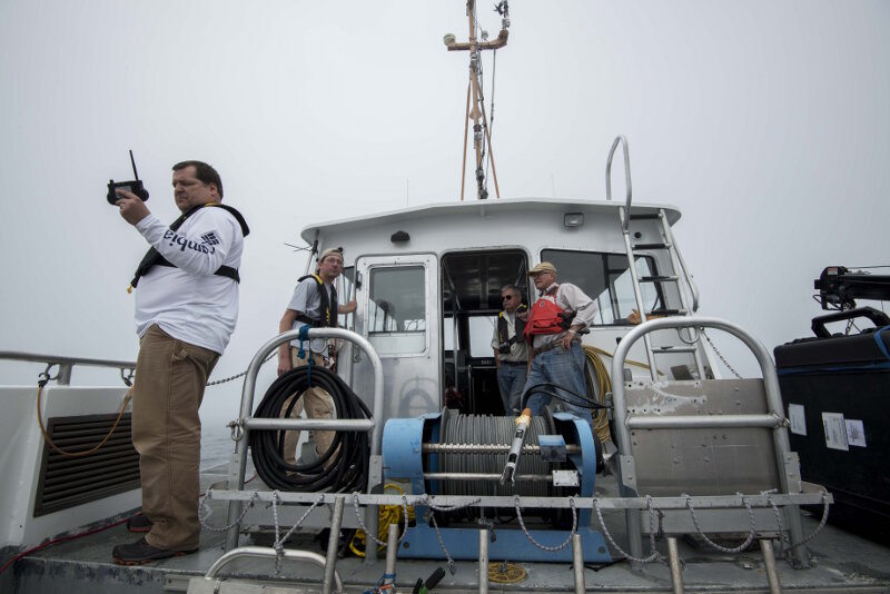
Project PI Dr. Guy Meadows looks across the lake surface into a dense fog surrounding R/V Storm. As the AUV missions progressed, the vehicle would periodically surface to update its GPS position. In addition to establishing a wireless connection, the survey team would also attempt to get visual confirmation of the vehicle’s status. This was extremely challenging, however, when socked in with fog. Image courtesy of Thunder Bay National Marine Sanctuary/NOAA. Download larger version (jpg, 5.8 MB).
Thunder Bay National Marine Sanctuary (TBNMS) researchers partnered with the Great Lakes Research Center at Michigan Technological University (MTU) to use their Iver3 AUV equipped with an EdgeTech 2205 interferometric sonar system to image shipwreck sites off Presque Isle, Michigan. Embarking on R/V Storm in late June, MTU and TBNMS researchers set out to collect high-resolution sonar imagery of historical shipwreck sites within the sanctuary, harnessing the power of cutting-edge AUV technology.
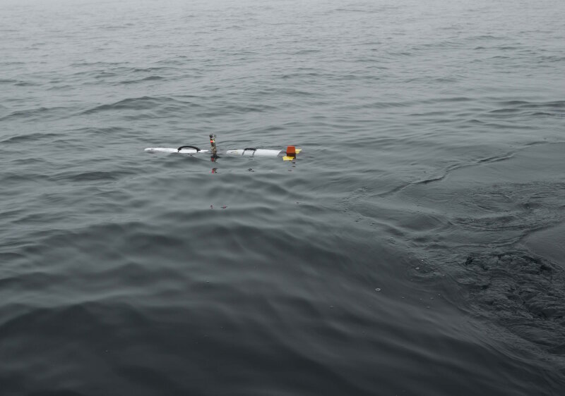
The Iver3 vehicle at the surface immediately following launch. The tower in the middle housed the GPS receiver, wireless receiver, and LED indicator lights. Image courtesy of Thunder Bay National Marine Sanctuary/NOAA. Download larger version (jpg, 3.9 MB).
An AUV mission is all about planning. Before the vehicle can enter the water, every detail of the survey must be decided and pre-programmed. The location and orientation of the target object becomes the nucleus of a systematic grid pattern; the number of reciprocal grid lanes must be determined, as well as their distance apart and their height from the lake bottom (or lake surface). Waypoints along each of these tracklines are set to determine when the sonar system turns on and off to log data, as well as when the vehicle ascends to the surface to take periodic GPS position fixes before transiting to another waypoint. Once arrived, the vehicle dives again along a new grid line, descends to the planned depth, and once again records sonar data. The composite of all these passes is stored in an internal computer onboard the AUV. Once the mission is completed, the AUV ascends to the surface and drives to a pre-programmed ‘park point’ to await recovery.
Back on the surface, the mission is monitored via timers and a wireless controller that establishes connection with the vehicle every time it returns to the surface for a GPS position update. While connected, the status of the mission is transferred and tracked. Depending on the number of planned grid lines, the AUV might run anywhere from 20 to 90 minutes. In the meantime, data from previous missions is evaluated and used to adjust the parameters of future missions to improve the quality of captured sonar data. Slight adjustments are made to the planning details of each subsequent mission based on an evaluation of the results of a given survey run. As a result, it can take several missions to develop ideal survey parameters.
Jamey Anderson (left), Marine Operations Coordinator at the Great Lakes Research Center, sends wireless commands to the vehicle at the start of a survey mission. Technician Chris Pinnow, Dr. Guy Meadows, and Michael Beaulac look on, ready to begin the topside mission tracking. Each run lasted between 30-90 minutes. Image courtesy of Thunder Bay National Marine Sanctuary/NOAA. Download larger version (jpg, 6.3 MB).
Throughout the project, the team surveyed several historical shipwrecks, with stunning results. Entire shipwreck sites were imaged, including the main structures and debris fields. This was especially apparent at the sites of schooners John J. Audubon and Typo. Lost in 1854 while carrying a cargo of railroad iron bars, a large debris field of these bars was easily discernable in the scans over John J. Audubon. Similarly, the large pile of coal pouring from the stern of the wooden schooner Typo was visible in the sonar imagery.
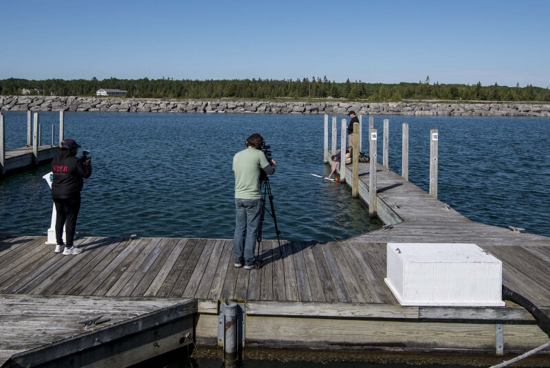
MTU’s Jamey Anderson and Chris Pinnow demonstrate the launch, operation, and recovery of the Iver3 AUV to a film crew from Alpena’s WBKB TV network. This demonstration took place at Michigan’s Presque Isle State Marina. Thunder Bay National Marine Sanctuary/NOAA. Download larger version (jpg, 3.2 MB).
On the water, the AUV is launched and recovered from the stern of R/V Storm. MTU’s Iver3 is so portable, it can be simply picked up and placed in the water, and vise-versa to recover. This feature, however, makes survey operations weather dependent. Recovering the vehicle, especially, is unsafe in rough weather. As a result, survey missions could not proceed during rough weather. Instead, the team used these days to invite local media to tour the research vessel and demonstrate the operation of the AUV and it support equipment.
Preliminary data from these surveys was viewed throughout Phase III. Much more processing, however, is yet to be done. The EdgeTech 2205 collected both side scan sonar and bathymetry information. The latter will provide 3D point cloud visualizations that will greatly enhance the interpretation of archaeological sites. Dr. Meadows and the MTU crew will continue to refine these datasets as divers revisit these sites during Phase IV to generate 3D photogrammetric models for comparison with the AUV-derived acoustic models.
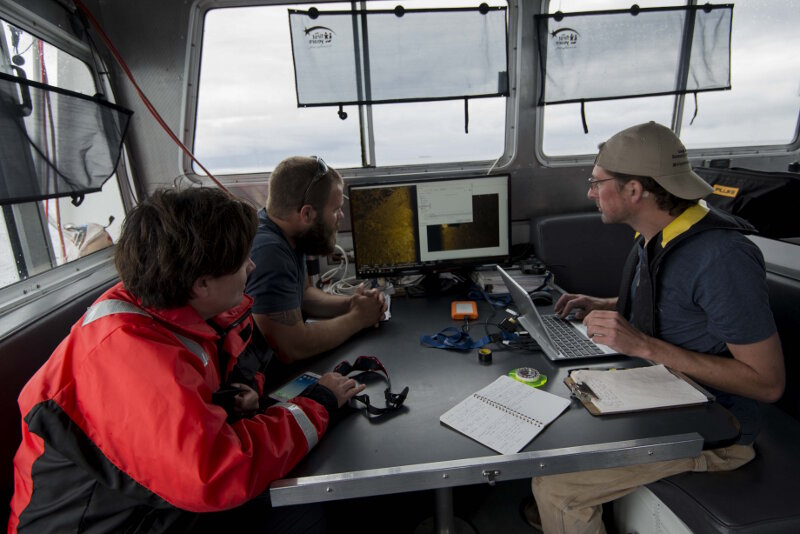
Maritime archaeologists John Bright and Stephanie Gandulla review sonar data with MTU’s Chris Pinnow following an AUV mission over bulk carrier Norman. Image courtesy of Thunder Bay National Marine Sanctuary/NOAA. Download larger version (jpg, 6.7 MB).
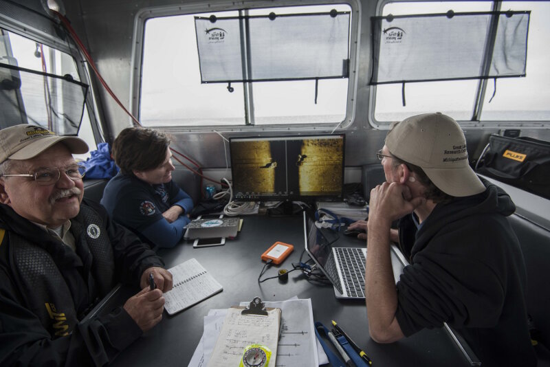
Dr. Guy Meadows and Chris Pinnow review AUV sonar data with Thunder Bay National Marine Sanctuary archaeologist Stephanie Gandulla onboard R/V Storm. Image courtesy of Thunder Bay National Marine Sanctuary/NOAA. Download larger version (jpg, 6.9 MB).
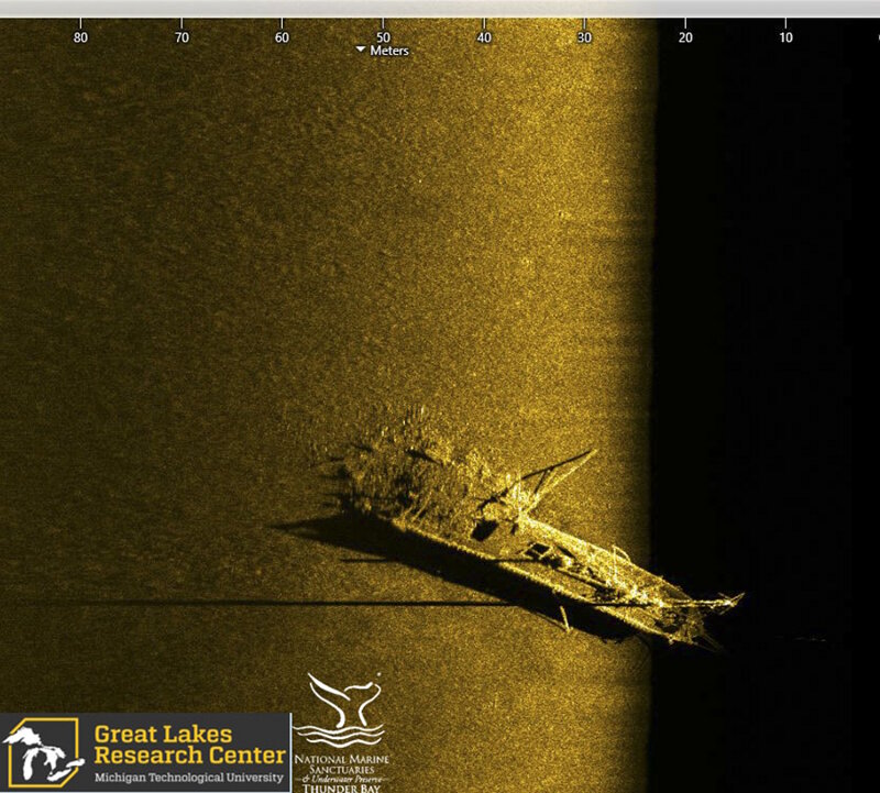
Side scan sonar image of schooner Typo, which collided with steamer W.P. Ketcham in October of 1899. The schooner, which was carrying a cargo of coal, was rammed in the stern. The sonar image shows the bow and upright foremast, cargo hatches across Typo’s deck, and the broken stern with a pile of spilled coal. Image Source: Michigan Technological University Great Lakes Research Center. Image courtesy of the Michigan Technological University Great Lakes Research Center. Download larger version (jpg, 561 KB).
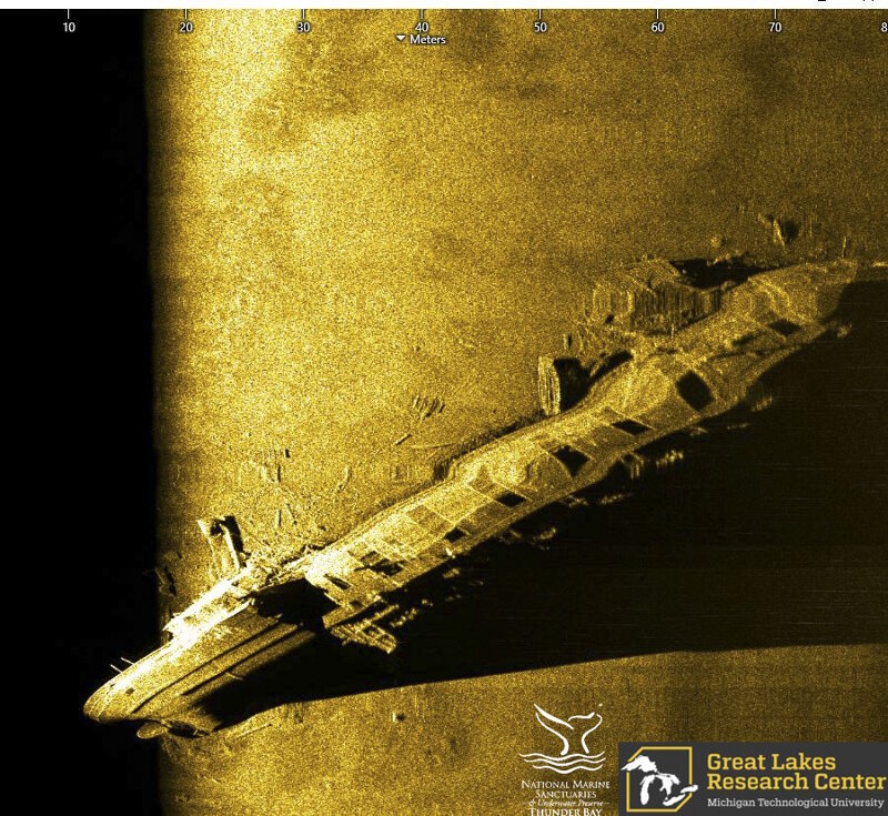
Bulk freighter Norman was a large steel vessel, the predecessor to the modern-day Great Lakes Bulk Carrier. In May of 1895, Norman collided with Canadian steamer Jack off Presque Isle; Norman’s hull was broken forward of the boiler house, causing it to sink in nearly 200 feet of water. This sonar image passes closely over the freighter’s stern, showing the side of the aft cabin, the break in the hull, cargo hatches moving forward, terminating at the vessel’s bow. Image courtesy of the Michigan Technological University Great Lakes Research Center. Download larger version (jpg, 611 KB).
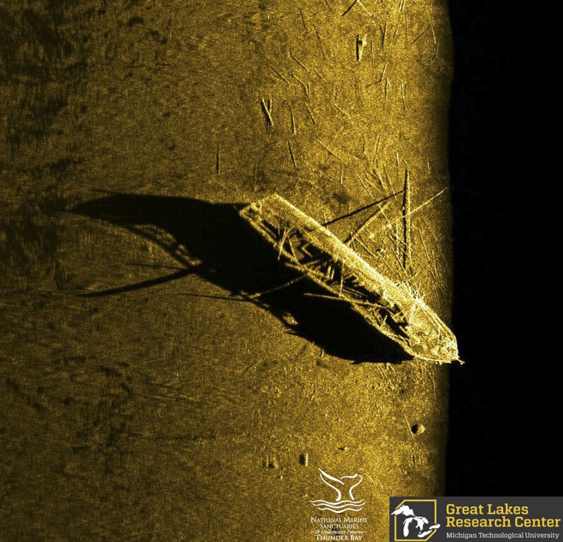
In October, 1854, schooners Defiance and John J. Audubon collided in a fog off Presque Isle. Both vessels quickly sank and now rest intact on the bottom of Lake Huron. This image shows a sonar scan of John J. Audubon, which went down with a cargo of railroad iron bars. Along with its masts and deck structure, scattered railroad iron can be seen on the lake floor surrounding the vessel. Image courtesy of the Michigan Technological University Great Lakes Research Center. Download larger version (jpg, 570 KB).