
May 15 - 26, 2017
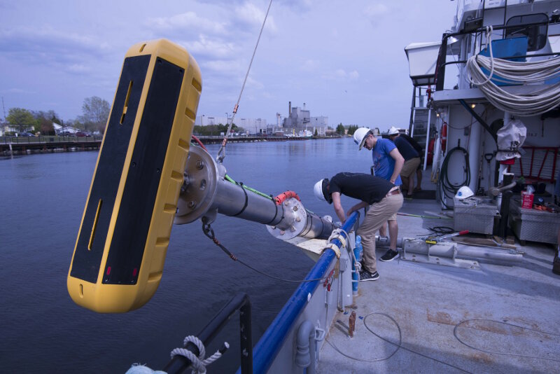
University of Delaware sonar technicians Kenny Haulsee and Peter Barron route cables from the echosounder (yellow device in foreground) along a pole mount used to lower and secure the echosounder along the side of the vessel. The team installed and tested the entire sonar system while dockside to ensure proper operation before getting underway within the survey area. Image courtesy of NOAA, Thunder Bay National Marine Sanctuary. Download larger version (jpg, 7.5 MB).
Dr. Art Trembanis and Carter DuVal, University of Delaware
John Bright, Stephanie Gandulla, and Philip Hartmeyer, Thunder Bay National Marine Sanctuary
Unexplored deep-water off Presque Isle in Thunder Bay National Marine Sanctuary's expanded area.
The acoustic remote sensing system was provided and operated by the University of Delaware:
NOAA R8001, R/V Laurentian. Andrew Yagiela (Captain), Beau Braymer (Captain), Jack Workman (crew), Todd Roetman (crew).
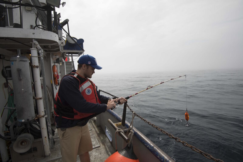
University of Delaware sonar technician Peter Barron prepares to lower a device that will measure the speed of sound throughout the entire water column. These sound velocity profiles were collected once every four hours during the entire survey. Image courtesy of NOAA, Thunder Bay National Marine Sanctuary. Download larger version (jpg, 6.1 MB).
Searching for lost shipwrecks in large bodies of water like the ocean and Great Lakes is challenging. It is often a situation of looking for a 'needle in a haystack,' where researchers must examine large areas of the seafloor or lake floor in their entirety just to locate a single historical shipwreck.
The tools used to conduct such a search vary greatly in terms of technological sophistication, resolution of data, available coverage, and ease of use. Generally, researchers use sound waves as their primary means of detection. Unlike the dry surface of the planet, where features can be documented with aerial imagery or satellites equipped with cameras, visual survey is not practical underwater. In some cases water is too murky, or turbid, to take photographs. At deeper depths there simply isn't any ambient light. A camera, therefore, would only see darkness unless an array of lights was lowered down with it to illuminate the area.
Sound, however, is astonishingly efficient underwater. The density of water, both freshwater and saltwater, allows sound waves to travel great distances. When these waves encounter an object, they bounce off and reflect back in the opposite direction of their original travel. In fact, by knowing the speed of sound through water (roughly 1,400 to 1,500 meters per second) the distance to an object can be calculated as the distance traveled in half the time it takes a produced sound wave to emit, reflect, and travel back. If the object being mapped is the lake floor, in this case the bottom of Lake Huron, the distance to the bottom, or water depth, can be determined by the time delay between a sound wave emitted at the surface and its travel to the lake floor and return back to the source at the surface.
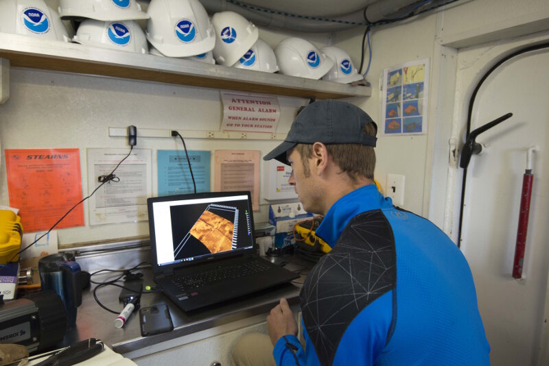
University of Delaware sonar technician Kenny Haulsee reviews sonar files as part of a data processing workflow. After processing each sonar file individually, they will be combined into a single, continuous mosaic. Image courtesy of NOAA, Thunder Bay National Marine Sanctuary. Download larger version (jpg, 9.5 MB).
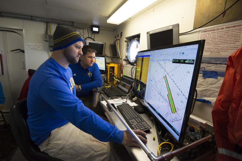
Co-Principal Investigator Dr. Art Trembanis sits watch with University of Delaware doctoral student Carter DuVal. Together, they monitor incoming sonar data and manage the navigation plan as the vessel’s captain steers a pre-planned course. Image courtesy of NOAA, Thunder Bay National Marine Sanctuary. Download larger version (jpg, 10.3 MB).
The behavior of sound in water is so reliable that hydrophers can make detailed maps of the seafloor, accurate to within inches. Archaeologists can also use this technology to locate undiscovered shipwrecks. Where the lake bottom is flat and even, a historical shipwreck will appear as a large 'anomaly' in the sonar data; a feature that sits upright off the bottom in stark contrast to the surrounding natural features. Once located, researchers can return with additional tools, such as underwater robots or divers, to further document a potential discovery.
A typical approach to exploring new areas is to utilize a sonar system capable of seeing a wide strip of the bottom, termed a 'swath,' within a single pass and running a pre-planned grid of overlapping passes to ensure complete coverage of a given area. This survey strategy is referred to as 'mowing the lawn' since it resembles a similar process for cutting grass. The tradeoff, however, is that the wider a sonar can scan, the less resolution (detail) it has in any given part of the resulting imagery. Thus, if an object of interest is found, it cannot be well characterized within the resulting low resolution imagery.
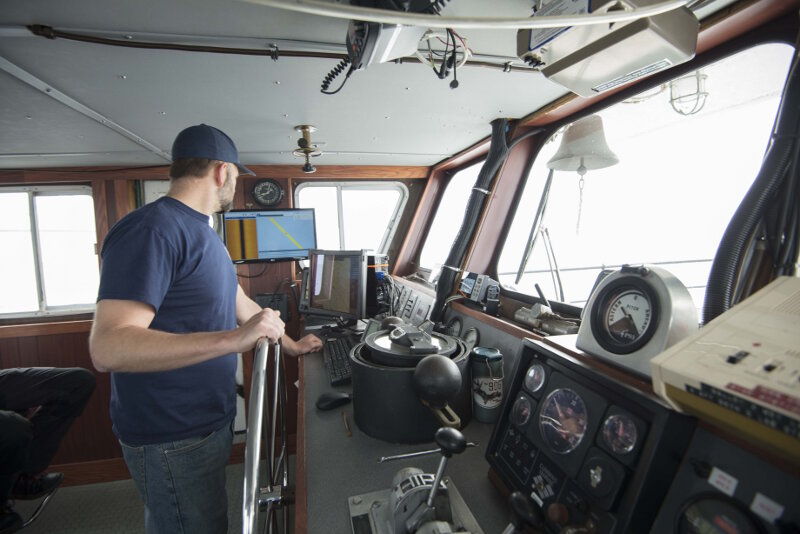
R/V Laurentian captain Beau Braymer pilots the vessel from the wheelhouse. A screen on the cabin’s portside wall relays the sonar feed and survey navigation information to help the captain maintain the correct course to ensure the sonar travels along parallel, overlapping lines. Image courtesy of NOAA, Thunder Bay National Marine Sanctuary. Download larger version (jpg, 6.1 MB).
As a result, a dual-phase approach is often needed, and the main goal of Phases II and III of this project. In the first phase, a wide-reaching sonar is used to scan large portions of the lake floor. By surveying large areas as quickly as possible, previously unexplored areas can be covered and new discoveries made. Once surveyed, archaeologists will examine the data and tag potential shipwreck targets. These are seen as anomalies against the surrounding lake floor. Their locations will be noted, and then used for subsequent investigation with more detailed documentation methods.
The water's off Presque Isle in central Lake Huron form a sort of crossroads for the area's shipping lanes. The lanes for vessels traveling up and down the lakes, whether to/from the Straits of Mackinaw or the Soo Locks, all converge within about 10 miles of the Presque Isle lighthouse. Within this area, many ships have collided and sank during periods of back weather or limited visibility. Dozens of known shipwrecks are spread across the lake floor off Presque Isle, and many more have yet to be found.
For this reason, researchers from Thunder Bay National Marine Sanctuary selected a large, 100 square mile area off Presque Isle for a wide-area exploratory survey. Partnering with the University of Delaware and using a research vessel from the NOAA’s Great Lakes Environmental Research Lab (GLERL), they conducted a two-week survey mission to search for undiscovered shipwrecks.
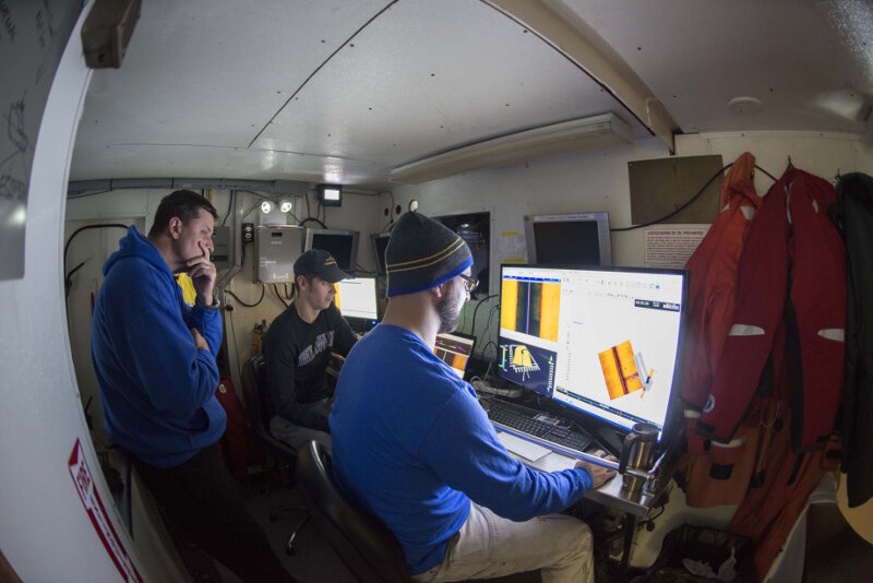
University of Delaware researchers monitor incoming survey data from R/V Laurentian’s science lab. Image courtesy of NOAA, Thunder Bay National Marine Sanctuary. Download larger version (jpg, 11.9 MB).
With a six-person survey crew, the mission involved 24-hour continuous operations for six days. Breaking into two-person watches, members of the team would spend four hours running the survey gear, followed by eight hours off, then another four hours on within a given 24-hour time period. In so doing, a team of researchers were constantly operating the sonar. This entailed logging and organizing data files, selecting and managing survey scan lines, and communicating with the research vessel's crew regarding navigation, survey speed, and general movement throughout the survey area.
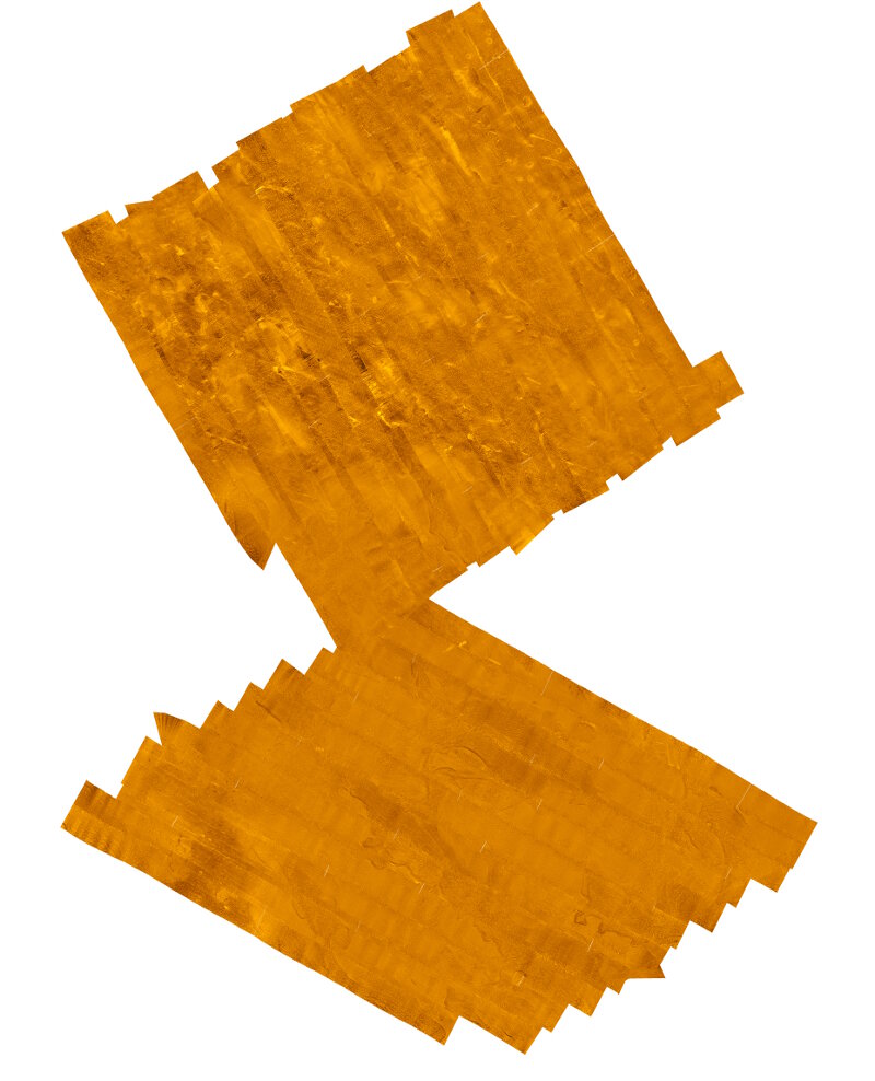
A preliminary side scan sonar mosaic composed of 24 individual survey lines. Across the lake’s bottom, numerous features can be seen, including geological formations and variable bottom types. Image courtesy of University of Delaware. Download larger version (jpg, 2.4 MB).
As sonar data was logged, additional measurements of the speed of sound through water were also taken. Approximately every four hours a device was sent to the bottom of the lake. As it traveled, it measured the speed of sound and produced a sound velocity profile. This information allows surveyors to accurately determine the distance to the bottom as a function of the time between sound waves leaving and returning to the sonar.
As six days passed, over 400 GB of sonar data was logged and 100 square miles of area were covered. Now, researchers have to process all of the data and review it for anomalous objects that may turn out to be new shipwreck discoveries. During Phase III operations, these targets will be investigated with high-resolution sonar onboard an autonomous underwater vehicle operated by Michigan Technological University.