
By Caitlin Adams, NOAA Office of Ocean Exploration and Research, Web Coordinator
September 15, 2017
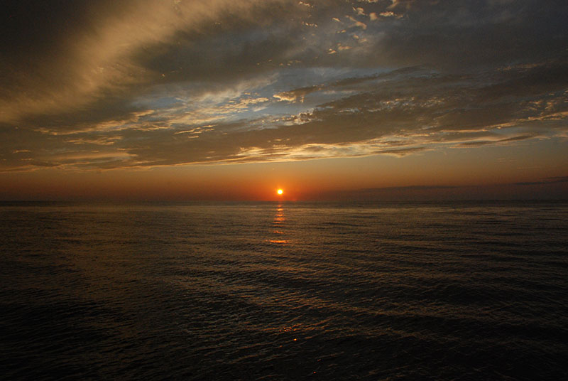
Though far in the distance, Jose’s storm clouds made for an impressive sunset on September 15. Image courtesy of DEEP SEARCH 2017, NOAA-OER/BOEM/USGS. Download larger version (jpg, 5.1 MB).
After looming out in the Atlantic all week, Hurricane Jose has finally become an unavoidable threat to the DEEP SEARCH team. Though the Pisces crew did their best to keep us operating in areas where the storm wouldn’t be a problem, that won’t be enough this weekend. Jose is expected to generate large swells (13 – 22 feet) throughout the entirety of our planned working area, and there’s just nowhere to avoid it.
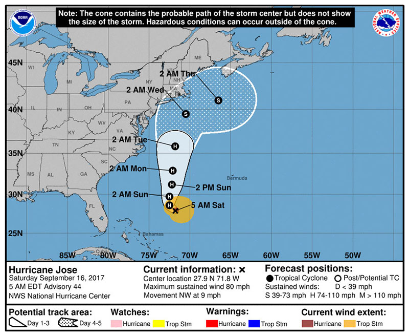
Though Hurricane Jose will not be making landfall anywhere near us, it is expected to generate significant swells and unfavorable conditions throughout the mid- and south Atlantic this weekend. Image courtesy of NOAA. Download larger version (jpg, 167 KB).
We were able to spend most of Friday’s daylight hours working in and around the Pea Island B site. Sentry completed a 21-hour dive and collected over 11,000 photos while on bottom — including one stunning shot of a hammerhead shark! We accomplished three more CTD casts ranging in depth from 281 to 793 meters.
Amanda and Jason spent their evening processing the sediment cores, while I filtered the 48 liters of water we collected (four 4-liter bottles per cast, three casts total). Since we sailed with very few scientists, a couple of us have pitched in and learned new protocols to fill in the gaps.
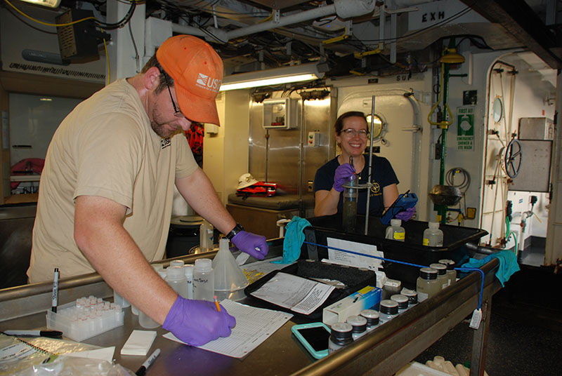
Amanda Demopoulos examines a sediment core while Jason Chaytor records her observations. Image courtesy of DEEP SEARCH 2017, NOAA-OER/BOEM/USGS. Download larger version (jpg, 4.4 MB).
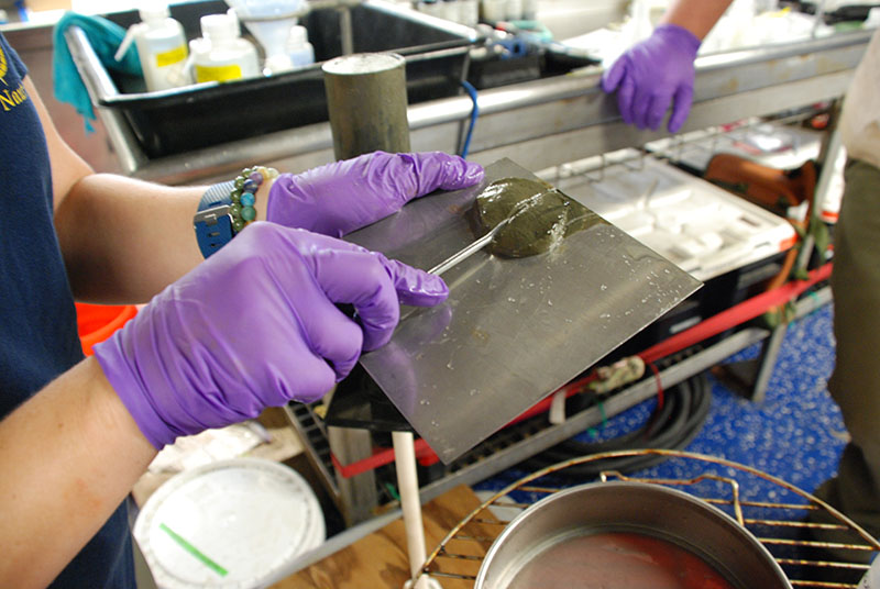
Amanda Demopoulos splits a one-centimeter thick core slice into two. Half will go to the U.S. Geological Survey (USGS) Woods Hole Coastal and Marine Science Center for geological assessment and the other half will go to the USGS Wetland and Aquatic Research Center for biological assessment. Image courtesy of DEEP SEARCH 2017, NOAA-OER/BOEM/USGS. Download larger version (jpg, 4.8 MB).
Once we finished the last cast, the ship’s centerboard was raised, and we officially began steaming back into port for the weekend. This time, we’ll be in our original planned port of departure, Morehead City, North Carolina. By making the transit south and around Cape Hatteras before ducking into port, we’ll be much closer to the southern sites that we want to target next. Both Savannah Banks (site 11) and Stetson Banks (site 10) have very little baseline maps available, so we’ll have a lot of work to do. Before we even put Sentry in the water, we will need to complete shipboard multibeam mapping of the seafloor, so we can have a clearer idea of what areas to more closely target with the autonomous underwater vehicle.
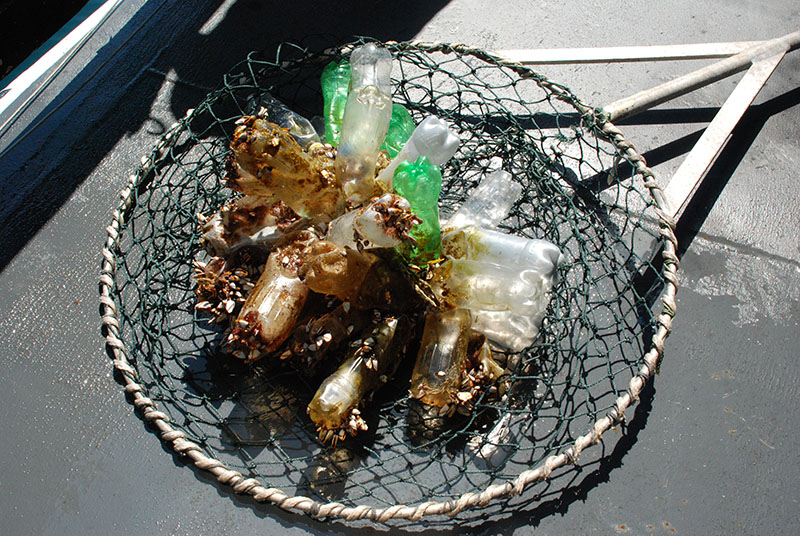
In addition to all of the science operations we completed on Friday, the ship’s crew also took the time to haul this large piece of plastic trash out of the ocean. Made of many plastic bottles tied together with rope, we think it was likely an improvised float for fishing. Image courtesy of DEEP SEARCH 2017, NOAA-OER/BOEM/USGS. Download larger version (jpg, 6.4 MB).

On a dive at the Pea Island B site, AUV Sentry captured this amazing shot of a scalloped hammerhead shark swimming along the seafloor 295 meters below the surface. Image courtesy of AUV Sentry, DEEP SEARCH 2017, NOAA-OER/BOEM/USGS. Download larger version (jpg, 4.6 MB).
Though we won’t be able to collect more data while in port, we luckily do have two Sentry dives worth of information to sort through! That’s 45 hours of bottom-time, 25,000 images, and at least a terabyte of seafloor data to work our way through...