By Dr. Amanda Demopoulos, U.S. Geological Survey
Dr. Erik Cordes, Temple University
September 11 - 28, 2017

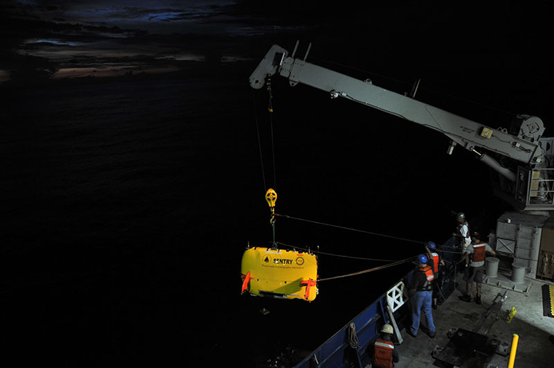
AUV Sentry being recovered during a recent cruise near Costa Rica. Image courtesy of Erik Cordes, Temple University. Download larger version (jpg, 570 KB).
Deep-sea ecosystems along the U.S. continental margin include coral reefs, natural gas seeps, and massive canyons lining the continental slope. They also include a water column component containing concentrated layers of organisms (called “deep-scattering layers”) that intersect the bottom habitats at various depths. These areas support enhanced biodiversity and sensitive biological communities, yet they remain poorly understood.
Loss of deep-sea biodiversity could have long-term, damaging effects to large expanses of the deep seafloor, the overlying water column, and to human health. The goal of this cruise is to improve our understanding of the distribution of these ecosystems in order to properly manage them. The improved understanding of the habitats and communities in offshore areas of the Atlantic Large Marine Ecosystem will improve our ability to predict the distribution of sensitive areas with respect to the potential development of energy and marine minerals managed by the Bureau of Ocean Energy Management and their concurrent mission to protect the environment.

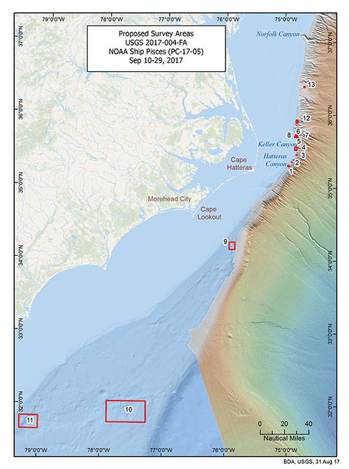
Map of target areas to be surveyed during the DEEP SEARCH expedition. Map courtesy of DEEP SEARCH 2017, NOAA-OER/BOEM/USGS. Download larger version (jpg, 2.7 MB).
From September 11 - 28, during the first cruise of the DEEP Sea Exploration to Advance Research on Coral/Canyon/Cold seep Habitats (DEEP SEARCH) program, we will use a combination of mapping with water column profiling and sampling to improve our knowledge of the geology of the region, the types of communities found on the seafloor, and the mid-water communities that interact with them. We will use the autonomous underwater vehicle (AUV) Sentry (Woods Hole Oceanographic Institution) to survey the seafloor and collect baseline imagery of seeps, canyons, and deep-sea coral features. For water column and sediment sampling, we will use a conductivity, temperature, and depth (CTD) rosette affixed with Niskin bottles to collect water samples at discrete depths. We will also use a monocore to collect sediment from the seafloor for every CTD cast. For mid-water trawling, we will use a Tucker trawl to collect samples of mid-water organisms (fishes, shrimps, squid, and larger zooplankton) at discrete depths within the deep-scattering layer . Lastly, we will collect high-resolution multibeam bathymetry using the ship-board mapping system to help fill in data gaps along the shelf and shallow slope within the region.
For this mission, we will transit from Morehead City, North Carolina, directly to survey several potential seep habitats located ~30 nautical miles from shore. From there, we will work our way north along the North Carolina coast, surveying known and potential seep and canyon habitats. Finally, we will transit south to dive on three sites (sites 9-11 on the map), completing our work offshore of Georgia.
Education and outreach activities will be an important part of the cruise, including highlighting the expedition both here and on the U.S. Geological Survey website. Check back here for frequent updates throughout the cruise.