
Joe Hoyt, Maritime Archaeologist - NOAA Office of National Marine Sanctuaries
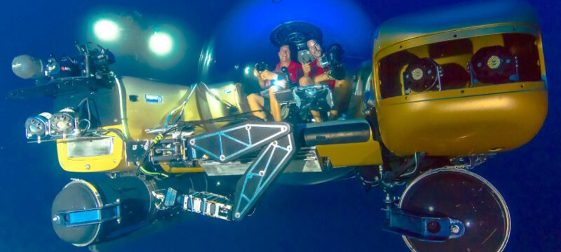
Triton submersibles will serve as the primary means of collecting data from the wreck. Image courtesy of Project Baseline/ Brownies Global Logistics. Download larger version (jpg, 398 MB).
NOAA’s Monitor National Marine Sanctuary, in partnership with the NOAA Office of Ocean Exploration and Research, Project Baseline, Bureau of Ocean Energy Management, University of North Carolina Coastal Studies Institute, and SRI International are undertaking a 15-day expedition to survey World War II (WWII) shipwrecks from the Battle of the Atlantic.

Bluefin 12 AUV system that will be used for multibeam data collection. Image courtesy of Project Baseline/ Brownies Global Logistics. Download larger version (jpg, 37 KB).
The primary focus of this mission is to completely characterize the remains of a WWII Naval Battlefield. For years, the Monitor National Marine Sanctuary (MNMS) has been conducting a series of comprehensive surveys of WWII shipwrecks off North Carolina associated with the Battle of the Atlantic (BOTA).
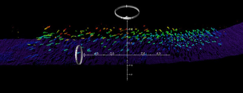
Multibeam image of a school of fish above the seabed. Photo courtesy of SRI. Download larger version (jpg, 351 KB).
An especially noteworthy action of the BOTA campaign was the KS-520 convoy battle on July 15, 1942. A brief, but chaotic attack on the convoy resulted in three torpedoed ships and a successful counterstrike on the attacking U-boat, culminating in the sinking of Bluefields and U-576, just moments apart. They now rest silently on the bottom as a memorial to this history and the structures have become habitat for a variety of marine organisms. This project aims to characterize these resources for both their historical and ecological importance.
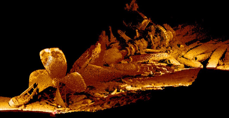
Sample of laser-quality data on a Great Lakes shipwreck. Photo courtesy of 2GRobotics. Download larger version (jpg, 1.4 MB).
In 2014, following years of research and searching, the remains of the KS-520 battle were discovered. These two sites sit approximately 250 meters apart in 750 feet of water unseen by human eyes since 1942. Only a cursory acoustic survey was possible at the time of discovery. Through the lens of Battlefield Archaeology, this expedition will conduct a comprehensive characterization and interpretation of these resources and the surrounding battlefield, along with related WWII shipwrecks lost in the area, using advanced data acquisition and visualization technologies. This study will provide data that will help tell an incredible story of a WWII battlefield just a few miles off America’s coast.
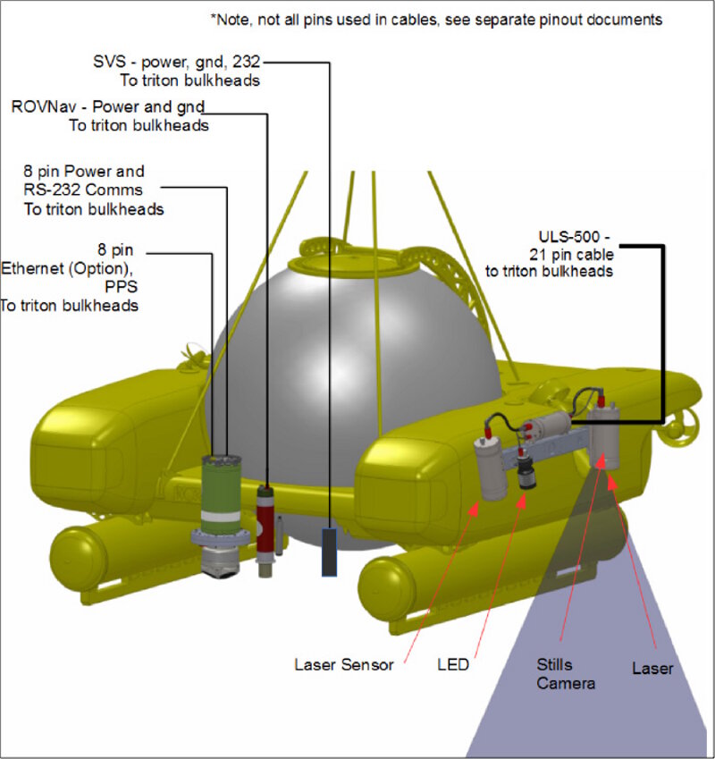
Laser scanning systems integration with Project Baseline submersible. Photo courtesy of 2GRobotics. Download larger version (jpg, 220 KB).
To capture the required data, NOAA and Project Baseline have assembled a collaborative team of expert scientists and explorers to dive down to the sites for the first time since they were lost in 1942.
The project has four major overarching goals:
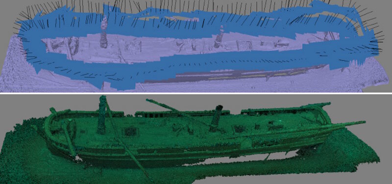
Top: Camera positions for each referenced image. Bottom: Dense point cloud model of a shipwreck site in 190 feet of water collected and processed by MNMS. Photo courtesy of MNMS. Download larger version (jpg, 718 KB).
To achieve these goals, the research team adopted an interdisciplinary approach to determine the methods and survey platforms. Data acquisition and survey payloads were chosen such that they would provide data that could be useful for both archaeological baseline characterization and for benthic habitat mapping. The project combines proven operational systems while testing novel and experimental approaches to deepwater shipwreck and biological recording and imaging packages.
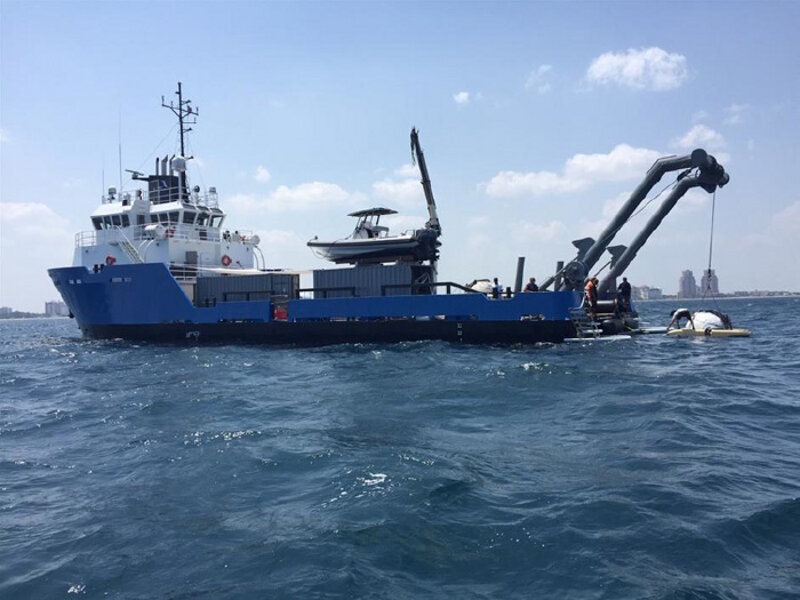
R/V Baseline Explorer will serve as the support vessel and home of the explorers while underway. Photo courtesy of Project Baseline/Brownie’s Global Logistics. Download larger version (jpg, 128 KB).
Three primary data types will be collected during this survey:
The basic data type that will be generated can also be readily cross-compared to evaluate efficacy. All sensors ultimately produce 3D point cloud data, albeit from different sensors: photography (photogrammetry); acoustic (multibeam); and laser (ULS scanner).
This technique uses still photographs to generate 3-D images. One submersible will be dedicated to video survey and photogrammetry. Several thousand still images will be collected in a pattern to ensure complete site coverage. The final data produced are photo realistic 3-D models, which can be used for site interpretation as well as public outreach.
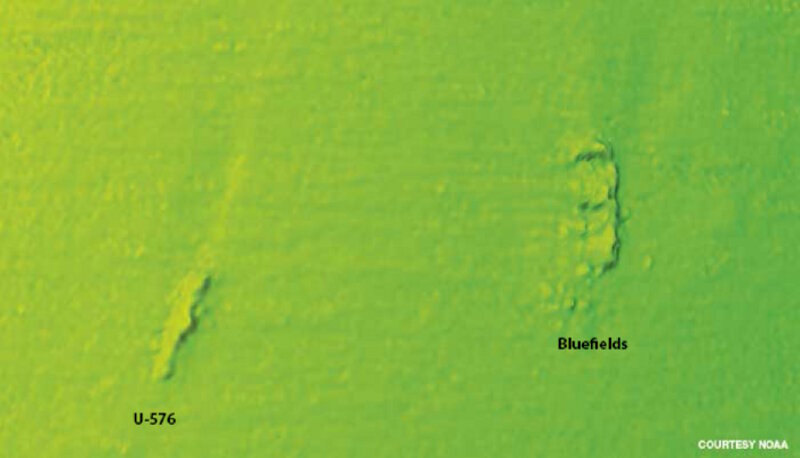
Multibeam sonar image of the Battlefield remains. Image courtesy of NOAA. Download larger version (jpg, 115 KB).
The 2GRobotics ULS-500 system will integrate into one of the submersibles, which will be dedicated solely to that purpose. Laser scanning can produce extremely detailed images of the site with sub-millimeter accuracy. These data can be used for both archaeological and habitat characterization.
Completing the sensor package is the high-resolution BlueView MB1350. This system will be mounted on the AUV and can cover a much wider area than the sensors attached to the submersibles described above. This system will generate bathymetric data and locate potential debris field areas associated with the convoy battle.
It will also be the primary tool for benthic habitat characterization and identifying biological resources in the water column. Flying the AUV close to the seafloor features will greatly enhance the resolution of both bathymetry and detection of fishes associated with shipwrecks and natural hardbottom habitats. Fine-scale structure of the seafloor is often lost due to expanding footprint and increasing noise of ship-based multibeam sonars.