
By Amanda W.J. Demopoulos, Research Benthic Ecologist - U.S. Geological Survey, Southeast Ecological Science Center
Jason D. Chaytor, Research Geologist - U.S. Geological Survey, Woods Hole Coastal and Marine Science Center
Cirrate, or finned, octopods (which are also known as “dumbo” octopods because the fins on the sides of their bodies make them look like the flying elephant in the Disney cartoon) can be divided based on their behavior. Some, like this one spotted during the Seamounts of Anegada Passage mission, spend a lot of time sitting on the bottom but sometimes get up and swim by a combination of fin flapping and jellyfish-like pulses of the arms and web. Video courtesy of the Ocean Exploration Trust. Download (mp4, 23.1 MB)
From September 3-13, 2014, U.S. Geological Survey (USGS) scientists led an expedition to explore the virtually unknown seamounts of the Anegada Passage, located in the eastern Caribbean.
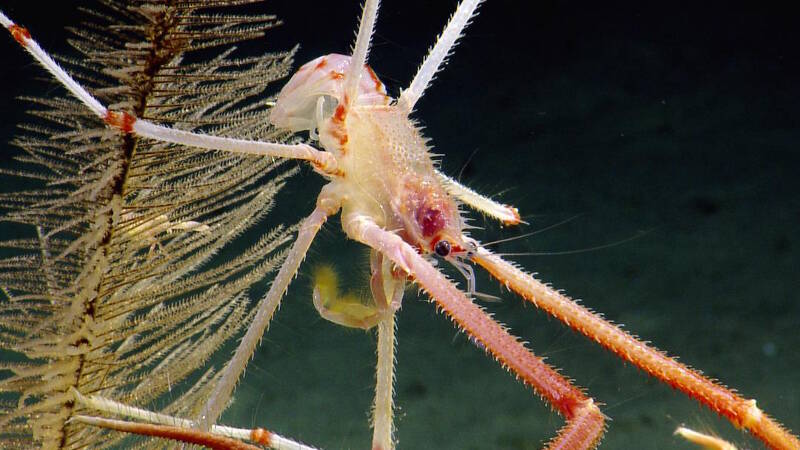
A squat lobster positions itself at the top of a black coral colony. Image courtesy of the Ocean Exploration Trust. Download larger version (jpg, 336 KB).
View a video about corals and their associates seen during the expedition.
We completed seven remotely operated vehicle (ROV) dives on three seamounts with ROVs Hercules and ARGUS, collecting 174 geological, biological, and chemical/water samples and acquiring 2,773 square kilometers of multibeam bathymetry data.
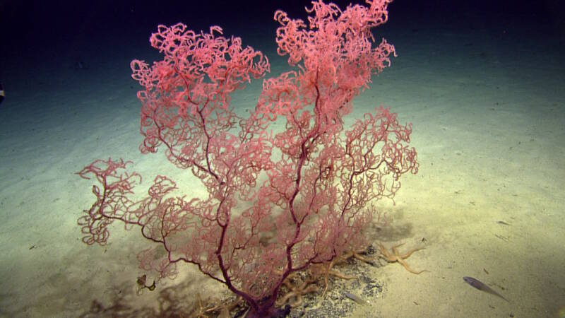
Based on the size of this colony, our team estimates that this is a particularly old colony of Leiopathes (black coral species). Image courtesy of the Ocean Exploration Trust. Download larger version (jpg, 464 KB).
This expedition yielded the chance to explore parts of the Earth never before seen by humans…and take some time out from the 24-hour-a-day schedule and enjoy a swim call on the beach on Peter Island, British Virgin Islands.
During this cruise, we collected a substantial amount of new high-resolution mapping data across the study area which has allowed for a reinterpretation of the seafloor morphology, including full realization of the shape, size (including determination of summit heights), and connections between five of the seamounts in the region. Furthermore, these new data have allowed for further reevaluation of surficial fault and structural trends within the Anegada Passage.
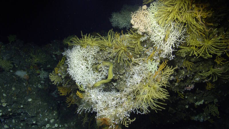
A sharktooth moray eel (Gymnothorax maderensis) skirts along an outcrop with several crinoids and many species of stony and octocorals on Dog Seamount. Image courtesy of the Ocean Exploration Trust. Download larger version (jpg, 1.6 MB).
Visual observations made during dives, preliminary evaluation of recovered samples, and integration of the new mapping data suggest, at least to some extent, that the origin of these seamounts is strongly controlled by the tectonics of the region, rather than simply volcanic activity. The presence of rock types not directly associated with volcanic activity, but similar to rock formations found on the Virgin Islands, is a strong line of evidence pointing to a Greater Antilles affinity and substantial tectonic activity. Detailed analysis of the rock samples and evaluation of the wider multibeam data set will be needed to evaluate these initial interpretations.
Video surveys of the three seamounts, Dog, Conrad, and Noroit, combined with discrete collections, enabled the first-ever characterization of the associated fauna, including deep-sea fishes, corals, and other invertebrates. Preliminary analysis of the dives revealed diverse communities with the potential for several new records for the region, including new depth records for fishes observed.
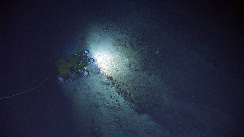
ROV Hercules investigates an outcrop with coral growing under the ledge. Image courtesy of the Ocean Exploration Trust. Download larger version (jpg, 1.8 MB).
Samples collected will be used to confirm identification of the fauna observed on the dives and to conduct age analysis of the octocorals found in the region. The age distribution of deep-sea corals on Caribbean seamounts is unknown, but we know from previous work conducted outside of the Caribbean that some species can live for hundreds of years.
Several of the samples collected also were processed to identify trophic linkages (i.e., who eats whom) and develop the first food-web models for the region.
Now that the expedition has ended, the real work begins. Data collected will keep our group busy for the next several years. Samples collected have been brought back to USGS labs and distributed to our partners at Temple University, University of Louisiana at Lafayette, NOAA, and Woods Hole Oceanographic Institution.
Our team will analyze samples and fit the puzzle pieces together as we build the first-ever baseline characterization of this region.
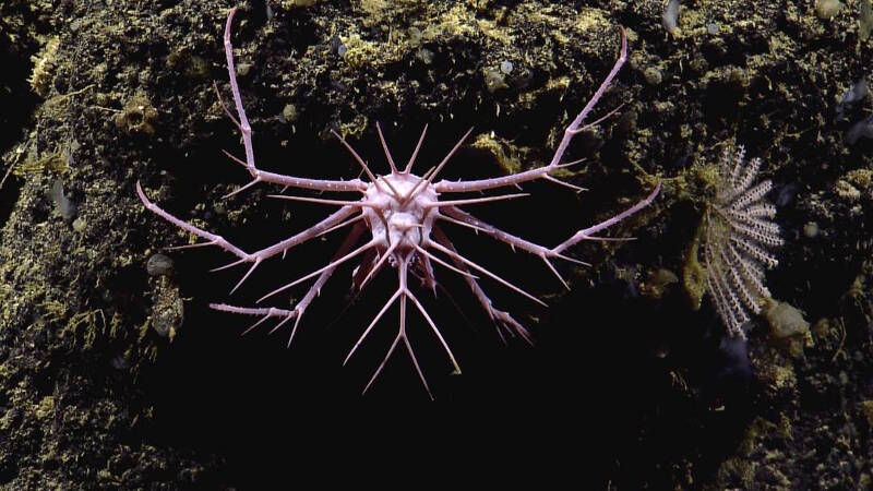
The seamounts were home to diverse communities of animals, including this spikey crab, which may be a recently described species of Neolithodes. Image courtesy of the Ocean Exploration Trust. Download larger version (jpg, 328 KB).
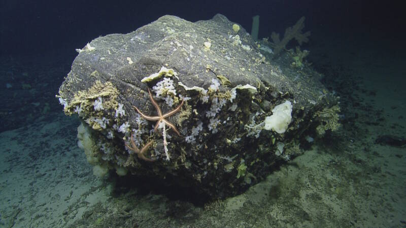
Large boulder which detached from flank of Dog Seamount and came to rest at its base. Image courtesy of the Ocean Exploration Trust. Download larger version (jpg, 1.5 MB).