
By Amanda W.J. Demopoulos, Research Benthic Ecologist - U.S. Geological Survey, Southeast Ecological Science Center
Jason D. Chaytor, Research Geologist - U.S. Geological Survey, Woods Hole Coastal and Marine Science Center
April 10-May 20, 2014
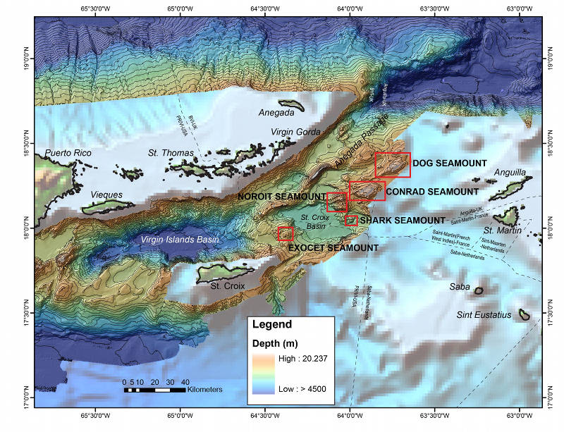
Areas to be explored during the Seamounts of Anegada Passage 2014 in the Caribbean outlined in red. Image courtesy of the USGS Woods Hole Coastal and Marine Science Center. Download larger version (jpg, 2.9 MB).
Several unexplored seamounts punctuate the seafloor within the Caribbean Sea, providing records of geologic, biologic, and oceanographic processes.
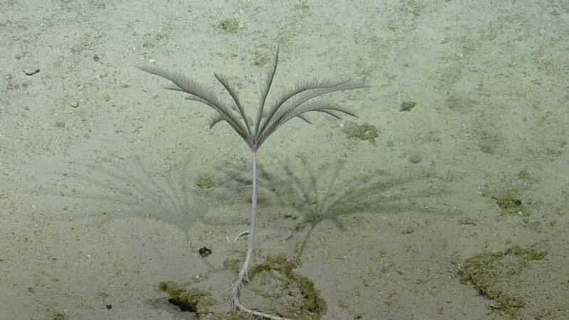
Stalked crinoids or sea lilies are a group of echinoderms that capture food particles from flowing currents. Some of the oldest fossils on the planet are of stalked crinoids, and they were once extremely abundant in geologic history. Image courtesy of the Ocean Exploration Trust. Download larger version (jpg, 1.1 MB).
Seamounts are topographically and oceanographically complex with environmental characteristics (e.g., substrate types, carbon flux, and current patterns) that differ greatly, both within and among seamounts. Variable environmental conditions may influence faunal community structure among seamounts, yet to our knowledge, no studies to date have examined these factors across multiple spatial scales of a seamount chain.
Seamounts have often been suggested to be oases, biodiversity hotspots, islands, and centers for endemism (being unique to a geographic area) in the deep sea. However, many of these hypotheses are only beginning to be explored in detail.
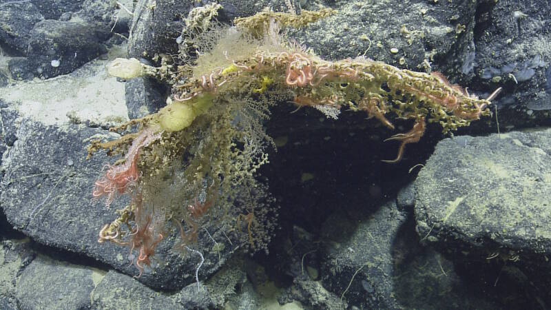
A diverse assemblage of scleractinians (stony corals), octocorals, and sponges on Noroit Seamount increase habitat heterogenoety, providing habitat for other animals, such as brittle stars and squat lobsters. Image courtesy of the Ocean Exploration Trust. Download larger version (jpg, 1.3 MB).
This mission represents an in-depth, multidisciplinary exploration of seamount environments that includes enhanced mapping efforts, remotely operated vehicle (ROV) surveys, discrete biological and geological collections, and ecological studies. The data collected will provide unprecedented insight into the geological origin, spatial distribution, ecology and biodiversity of seamount environments.
This expedition represents the only sampling cruise of the two-year project investigating and exploring seamounts in the Anegada Passage, eastern Caribbean. This project is sponsored by the NOAA Office of Ocean Exploration and Research and the U.S. Geological Survey, in collaboration with several academic institutions.
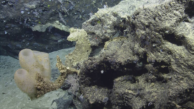
Hexactinellid sponges (glass sponges) and octocorals often colonize seamount hard substrate. Image courtesy of the Ocean Exploration Trust. Download larger version (jpg, 1.3 MB).
The Seamounts of Anegada Passage mission will start and end in San Juan, Puerto Rico. Each day will involve a combination of multibeam mapping and sub-bottom profiling, coupled with ROV operations exploring as many as five seamounts. There will be 31 scientists, technicians, and students on the E/V Nautilus, helping support this mission.
During our previous expedition to Noroit Seamount (E/V Nautilus, Oct. 2013), at least 27 putative deep-sea coral species, as well as several sponges, echinoderms, and fishes were documented in the small section of the seamount surveyed. This region may serve as a conduit between Atlantic, Bahamas, Caribbean, and Gulf of Mexico fauna. Exploration of the faunal communities will enhance our understanding of the connectivity among these important regions.
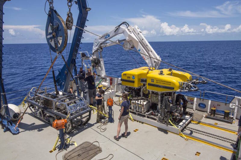
The Argus stabilizing platform and Hercules ROV on deck being prepared for a dive. Image courtesy of the Ocean Exploration Trust. Download larger version (jpg, 320 KB).
Using the scientific instrumentation on the E/V Nautilus and the dual-bodied ROV system Hercules/Argus, scientific objectives of the expedition include:
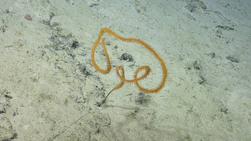
Stichopathes sp. (black corals) are common inhabitants of deep sea environments. Image courtesy of the Ocean Exploration Trust. Download larger version (jpg, 404 KB).
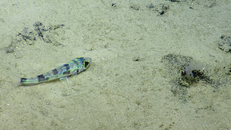
Chlorophthalmus agassizi (greeneye fish) is commonly observed resting on soft sediment habitat. On the right is a hexactinellid glass sponge. Image courtesy of the Ocean Exploration Trust. Download larger version (jpg, 1.2 MB).
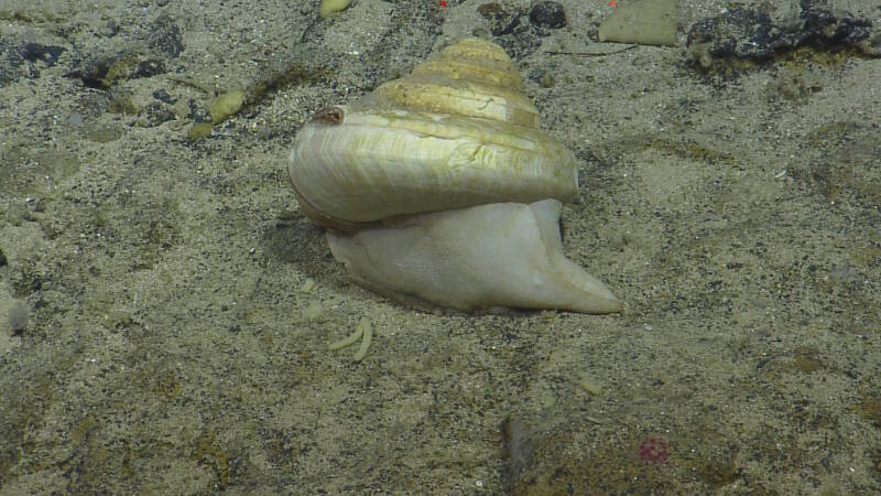
Close-up images of gastropods (Phylum Mollusca) such as this are rarely captured in deep sea habitats. Image courtesy of the Ocean Exploration Trust. Download larger version (jpg, 1.3 MB).