By M. Dennis Hanisak, Chief Scientist for Coral Reef Connectivity 2013 Cruise, and Research Professor - FAU Harbor Branch
August 26, 2013
Video from the ROV at approximately 80 meters (262 ft) on Pulley Ridge shows a number of algal species including Anadyomene menziesii and calcified crustose algae. The large red grouper and the small reef fish are all native to the area. The lionfish are not. Video credit: Brian Cousin, Florida Atlantic University Harbor Branch. Download (mp4, 4.8 MB).
A major task of our cruise is to characterize benthic habitat at Pulley Ridge and the Dry Tortugas area by conducting video and still image transects with a remotely operated vehicle (ROV). We wish to document and analyze the distribution of mesophotic habitat, hard-bottom and coral communities, and fish communities. Our “Community Structure” science team (Dennis Hanisak, John Reed, and Stephanie Farrington from FAU Harbor Branch, and Stacey Harter from NOAA Fisheries) are using University of North Carolina Wilmington’s Super Phantom S2 ROV, deployed and piloted by a gifted trio (Lance Horn, Glenn Taylor, and Jason White).

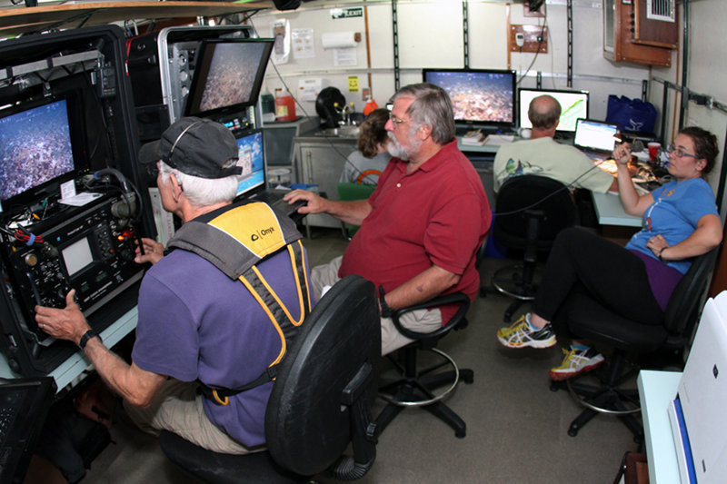
The ROV team collaborates with the mission scientists collecting video and still images that will be used to characterize habitat and provide clues to population connectivity in the study area. Image courtesy of Brian Cousin, FAU Harbor Branch. Download larger version (jpg, 779 KB).
ROV navigation uses a positioning system that calculates real-time position throughout each dive. During our transects, the pilot maintains the ROV at less than 1 meter off the bottom. Digital video and still images are recorded along our dive tracks with external pan and tilt cameras. Both cameras have parallel lasers for sizing objects and calculating densities of organisms. We record continuous video for the duration of each dive to provide a complete record of our observations and descriptions of habitat and biota. These data are entered real time into a database and include important details such as date, time, georeferenced coordinates, depth, height off bottom, ROV heading, course over ground, speed, habitat descriptions (habitat type, geomorphology, estimated percent cover), and biota descriptions (species, estimated sizes, and abundance). A digital still camera is positioned straight down, approximately 1 meter off the bottom. Our goal is to take 30 photos in each of our transects to quantify benthic cover.

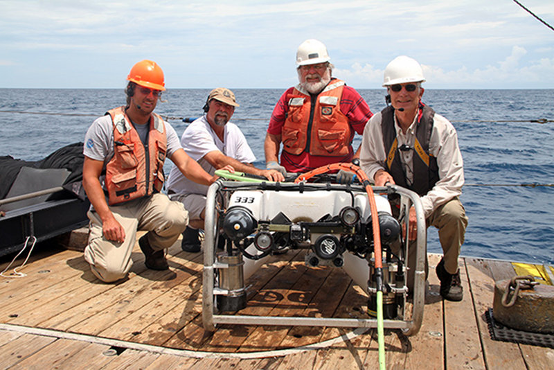
The UNCW Undersea Vehicles team with cruise Chief Scientist Dennis Hanisak (third from left). Jason White (left) is the newest member of the UNCW team. Lance Horn (second from left) is Chief Pilot and manager of the program. ROV pilot Glenn Taylor (right) is retiring at the end of the year after one more cruise. Front and center is the Super Phantom S2 ROV which has made a career 2298 dives. Image courtesy of Brian Cousin, FAU Harbor Branch. Download larger version (jpg, 1.0 MB).
We have been doing 2-3 ROV dives per day from the R/V Walton Smith. Site selection for our surveys is based primarily on existing multibeam and sidescan sonar maps. Our dives sites are 1-km x 1-km blocks, randomly selected before the cruise from a grid of the large area encompassed by our project. In each block, we conduct five quantitative video/photographic surveys. Each survey takes about 15 minutes and covers 100 m of the bottom. The starting point and direction of a transect, and the transit between surveys, are randomized, based on the possible directions that the ship and ROV can work. Strength and directions of currents and winds often limit what we can do at a particular site and time, based on the expert judgments of the ship’s Captain and Chief ROV Pilot Lance Horn before and during each dive.

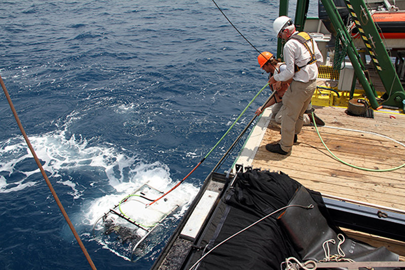
ROV veteran Glenn Taylor and new pilot, Jason White, recovering the Super Phantom S2 ROV to the deck of the R/V Walton Smith. Over the course of the cruise, Jason filled all ROV roles from deck duty to piloting the vehicle. Image courtesy of Brian Cousin, FAU Harbor Branch. Download larger version (jpg, 1.3 MB).
Each dive involves considerable teamwork with the science team relying on excellent maneuvering of the ship by the Captain and of the ROV by the pilots, who take turns at the helm for different transects or dives, while another one tends the tether from the deck. Each scientist plays a role during the dives. Typically John provides narration and initial interpretation of what we are observing during the dive; working off a large wide-screen monitor, Stacey is making and logging initial identifications and counts of all fish during the dive while Stephanie is doing the same on attached organisms (primarily corals, sponges, and algae). Dennis Hanisak is at the ROV science station working with the ROV pilot to take the still photographs

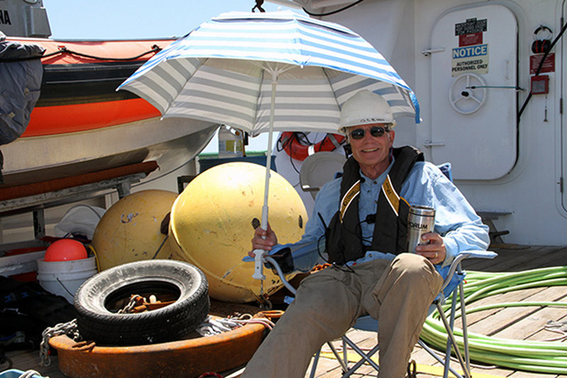
After almost 20 years of operating ROVs, Glenn Taylor is retiring at the end of 2013. In that time he has learned a thing or two about ROV operations, including how to stay out of the burning sun while standing watch during an ROV dive. Congratulations and thanks, Glenn. Image courtesy of Brian Cousin, FAU Harbor Branch. Download larger version (jpg, 889 KB).
After the cruise, the video and still photos will be analyzed for GIS mapping of major habitat types. Original field transcripts will be summarized to produce habitat descriptions and identify transitions between habitats. The distribution and abundance of fish species will be characterized from the videos. Benthic coverage of corals, sponges, and algae will be quantified from high-quality still images. These data will lead to describing and understanding community structure and patterns of species distribution and abundance, which is the foundation for determining the functional mechanisms and processes operating within these communities and developing predictive models that will be major outputs of our five-year study.