By Sandra Brooke - Marine Conservation Institute/OIMB
August 17, 2012

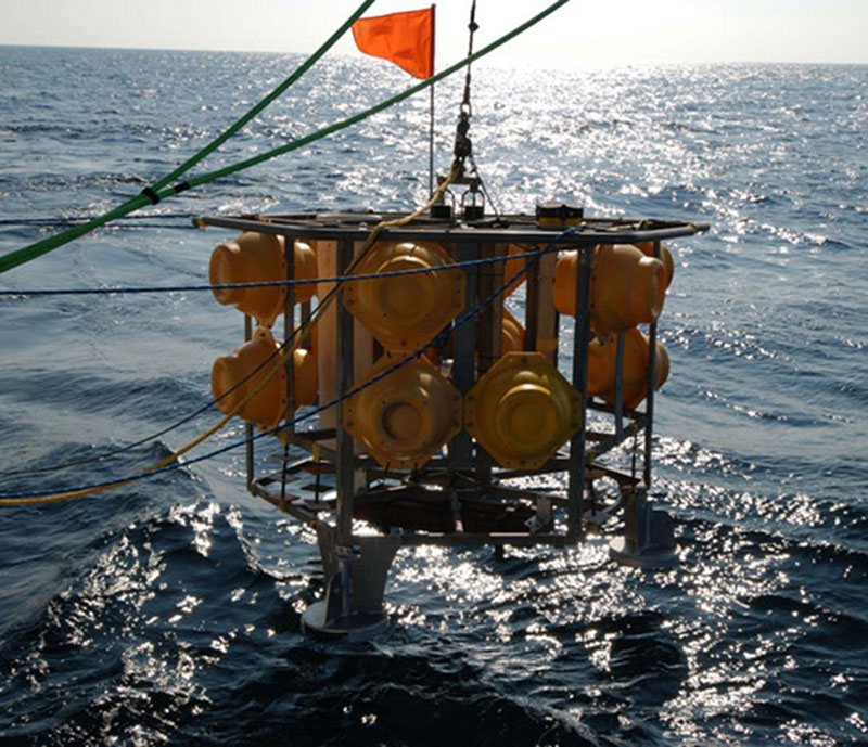
The ‘BOBO’ lander (owned by our Dutch colleagues at NIOZ in the Netherlands), being deployed in Norfolk canyon at 1364 m depth. Image courtesy of 2SW Ross, Deepwater Canyons 2012 Expedition, NOAA-OER/BOEM. Download image (jpg, 159 KB).

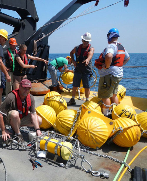
Dr. Brendan Roark (Texas A and M) attaching instruments to the mooring while scientists and deck crew discuss deployment logistics. Image courtesy of S Brooke, Deepwater Canyons 2012 Expedition, NOAA-OER/BOEM. Download image (jpg, 105 KB).
Our first real day of work at sea began in the early hours of this morning when we arrived at Norfolk canyon on a beautiful calm summer day. Our goals were to deploy two benthic landers (owned by our Dutch partners at NIOZ) and a mooring (owned by USGS) at different locations within the canyon axis. We deployed the first lander at the deeper end of the canyon at just over 1300m depth. Each of the landers and the mooring have rotating sediment traps that allow us to measure monthly deposits of material falling to the seafloor. These have to be filled with seawater from the same location that they will be deployed in, so the first task was to collect water from near the bottom. There was a minor glitch with the collection when the water bottles on the rosette didn’t fire, but the ship technicians fixed this promptly and we soon had sufficient frigid water for the task. It is not unusual to have small problems when we put electronics and seawater together – they don’t always play nicely. The landers and moorings are sophisticated technologies and require a great deal of TLC; instruments have to be mounted and programmed and the sediment traps need to be loaded – a very fiddly job, particularly as we add some rather nasty chemicals to preserve the samples. Eventually the lander was ready to go and the deployment went smoothly. The mooring took rather longer and was more of a convoluted process as it is 50 m long and had to be laid out on deck then slowly fed overboard until we reached the 2500 pound weight. The crane dropped this off the fantail and it dragged the rest of the mooring down with it. The process took about 4 hours but went pretty smoothly and by 2pm our mooring was sitting on the seafloor in the middle of Norfolk canyon. The last task of the day was to deploy the second lander near the head of the canyon, which was accomplished by early evening. We have left Norfolk canyon with instruments recording detailed environmental data along the canyon axis for a whole year. This will be an unprecedented data set and will allow us to determine the water conditions, patterns of current flow in the canyon and amount of organic material (which means food!) arriving at the seafloor. Now we are heading off to Baltimore canyon for the first ROV dive so hopefully tomorrow we will have some nice pictures of the animals that live there. Stay tuned!