By Chris German, Woods Hole Oceanographic Institution
April 23, 2012

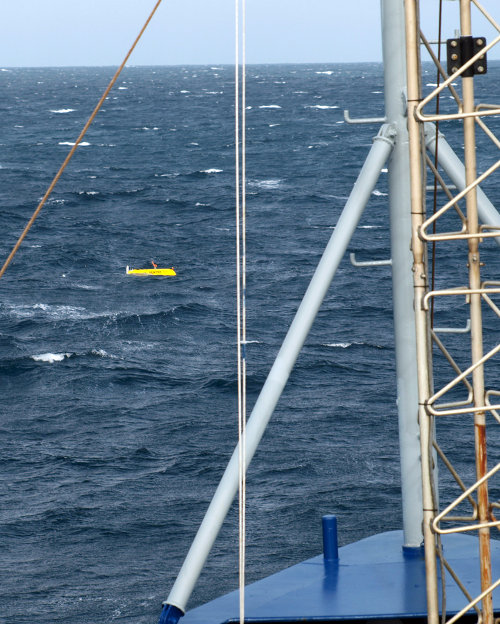
Sentry looks truly tiny when it first comes to the surface just ahead of the bow of the ship, 300 meters distant among white-capped wave-tops. Image courtesy of Chris German, INSPIRE: Chile Margin 2012 Expedition, NOAA-OER. Download larger version (jpg, 1.8 MB).
Hmmm... An interesting day. Remember how in my last log, I left off with "anything may happen next" or words to that effect? Well, the thing about autonomous vehicles is that they do tend to have a mind of their own.
So Plan A for last night was to launch Sentry, let it start running its own survey to map and image the seafloor and then follow along behind, towing our CTD system up and down through the water column to prospect for water column signals along the center line of the Sentry survey. So far so good – until we worked out what direction the currents, waves, and wind were coming from and realized that while Sentry was running its initial survey, we would want to run the CTD line in the opposite direction, and we couldn't really plan to run both lines at once, headed directly toward one another at roughly 3,000 meters beneath the waves.
So Plan B for last night was to set Sentry running, let it run the first four-mile line of its survey, step across for its next four-mile run, and then start the CTD survey in the opposite direction. But then Sentry started running its survey along a line that wasn't quite the one intended. Instead of following a heading of 172°, it followed 163°, which didn't sound like much until you plotted where it was headed. This revealed that instead of running along the ridge axis parallel to steep cliffs all night, just about every survey line would see Sentry driving straight toward, or away from, a steep cliff, which at best would be challenging for the vehicle and at worst would risk crashing when flying at survey speeds close above a lumpy seafloor.

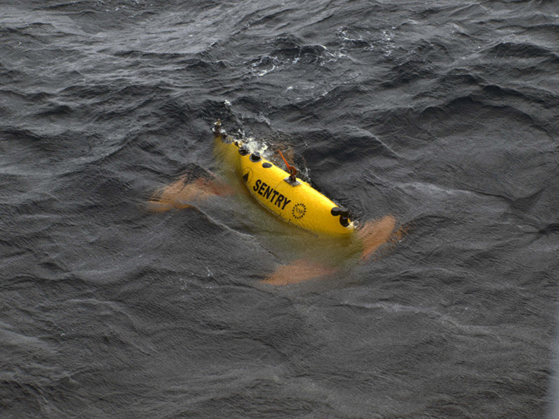
Once the ship comes close enough alongside, Al uses a remote control system similar (in principle) to that of a remote control car to drive Sentry in close beside the ship - at which point Andy, assisted by Justin and Tim, use hooks on poles to latch strong lines on to Sentry so that it can be lifted aboard ship. Image courtesy of Chris German, INSPIRE: Chile Margin 2012 Expedition, NOAA-OER. Download larger version (jpg, 3.1 MB).
So Plan C for last night was to re-program Sentry while it was still in the water by sending it messages via soundwaves broadcast from the ship, telling it where to start and end each survey line. And the only way to do that was to keep the ship very close to Sentry all night (so that we were within hailing range), which meant no simultaneous CTD operations.
So far so good (hope you're still with me), and by around midnight, Dana, Carl and I had worked out a plan in which I would stay up with Dana to start making the shifts. Once we had everything running and stable, Dana would go to bed, with Carl getting up early next morning to oversee sending Sentry the next set of instructions. Progress, it seemed. One last conversation with Donna and we agreed that as soon as Sentry had finished its work (around 8 am, we expected, because of a weather forecast that said we would have to stop work then to get Sentry back on deck safely), then it would be priority number one to do the CTD tow-yo we had just had to cancel for last night.
Hmmm – when to sleep? This was a fateful question to ask, it transpired. Around 2 am, we had made the first set of Sentry shifts, and Dana had departed. Al was looking after things and all looked very reliable – indeed, we calculated that Sentry was now doing just fine and there would be no need for any further activity for at least four hours, maybe five. Seizing my chance, I snuck off for a power nap, setting my alarm for 5:30 am. This would be just fine, I told myself – I'd be back up at 5:30 am to confirm that Sentry still had 30-60 minutes to go on that survey block, which meant I could wake Carl in good time to make the next set of changes.

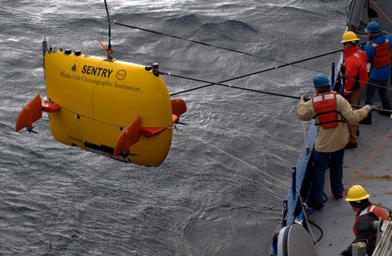
Tim (bottom of picture) handles the line attached to the front of Sentry while Andy uses a fiberglass pole to keep things aligned. Keith (second from top of picture) overseas operations and gives directions to the crane driver while Justin uses a second pole to prepare to attach the third line to the rear of the vehicle. Image courtesy of Chris German, INSPIRE: Chile Margin 2012 Expedition, NOAA-OER. Download larger version (jpg, 3.4 MB).
I got down to the lab at 5:45 am and found out that Plan D for last night was now in full swing. Sometime in the four hours I had been away, Sentry had decided that whatever was causing it to drive offline with its programmed heading was no longer an issue, so now it was going to go back to driving on its original heading. Great, you might think – except that now it was driving on that heading along a completely different set of survey lines.
So it was time to get back to the drawing board and work out, first, how to keep Sentry away from the cliffs and then, once that was taken care of, how to get Sentry back surveying the parts of the seafloor we most cared about. Suddenly it was 8 am, and Dana was back on watch while Carl could get back to sleep for another all-too-few hours. Working with the data recorded from aboard ship, Dana was able to plot up for me everywhere that Sentry had been to so far, compared to everywhere we wanted to have imaged. Between around 9 am and midday, we were able to redirect the final survey line to cover the few missing regions of the study area we first intended.
Overall, we think we got to map out 80 percent of the area and, indeed, the part we missed was our lowest-priority 20 percent that we would have missed if the weather had turned bad sooner. At just before noon, Sentry reached the end of its mission and by 1 pm was back at the ocean surface. The weather on deck was definitely more blustery, with higher waves than when we launched last night but all was soon safely aboard ship.

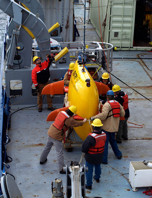
After some careful handling and operations – especially on an increasingly lively ship as the weather picks up – Sentry is safely lowered back into its cradle. Almost immediately, downloading of the data from the just-completed mission and servicing of the vehicle to prepare it and get it ready for the next dive will begin. Image courtesy of Chris German, INSPIRE: Chile Margin 2012 Expedition, NOAA-OER. Download larger version (jpg, 2.5 MB).
Now comes the point where the Sentry team download all the data and start the processing necessary to hand the data off to us hungry scientsists. In parallel, we also need them to start looking at what was going wrong with Sentry overnight so they can start diagnosing the problems and deciding on any repairs that might be required as well as getting the batteries recharged for the next mission.
In the meantime, up next will be, in order: the CTD tow-yo, deployment of the multi-corer to collect sediments for biological analyses, and first deployment of the tow-cam. By then, we hope to have all the sidescan sonar data downloaded and processed to generate maps for us to study. We're hoping to see what can best be described as what we would see if we were to drain the ocean dry and shine a flashlight across the seafloor at night, looking for the interesting lumps and bumps that might tell us where an active vent might be. To put it more poetically, as soon as we get those data, we're going to start chasing shadows...