
By Jeffrey B. Glover, PhD - Department of Anthropology, Georgia State University
October 7, 2011
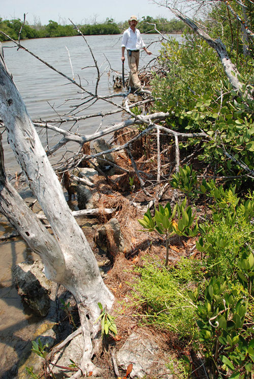
Dr. Jeffrey Glover stands at the end of an interesting rock alignment discovered at the waters edge of the East Harbor. The rocks parallel the current shoreline. Image courtesy of Proyecto Costa Escondida Maritime Maya 2011 Expedition, NOAA-OER. Download larger version (jpg, 4.5 MB).
The archaeological investigations to date at Vista Alegre, like many preliminary archaeological projects, have consisted of two main activities – survey and excavation. While excavation is typically what the public associates with archaeological fieldwork, survey is an integral component of fieldwork and an activity near and dear to me. In fact, excavation is a destructive and costly (both in terms of time and resources) process, so good archaeologists should not undertake excavations without having conducted a general survey first. In the case of Vista Alegre, our first activity at the site in 2005 was to create a map of as much of the site as possible (MAP). This then allowed us to determine where to place excavation units to address particular questions in future field seasons (i.e., chronology, subsistence, etc…).
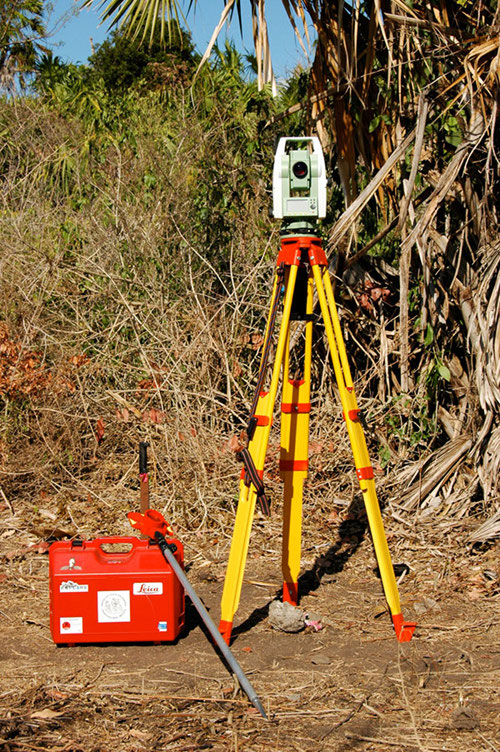
The electronic total station is set up at Vista Alegre to create a topographic map of the site. The device uses lasers and a prism to create a very precise and detailed map. Image courtesy of Proyecto Costa Escondida Maritime Maya 2011 Expedition, NOAA-OER. Download larger version (jpg, 5.8 MB).
We conducted both activities during this expedition.
The survey and mapping during this expedition had three main goals – 1. the identification of features (submerged or at the shoreline) that might reveal particular port-related activities (i.e., docks, storage facilities, formal paths, etc…), 2. the continued mapping of the site’s topography, and 3. to document the location of the new excavation units.
Emily McDonald and I did some survey work on the eastern shore of the island and identified four features that had previously been unrecorded. Of particular interest is a rock alignment right at the water’s edge). Could this have been a small breakwater, a mooring locale, a dock, or part of a larger feature that has long since suffered the ravages of time? Like much survey work, more focused research is needed to sort out what role this feature may have played in the maritime commerce at Vista Alegre.
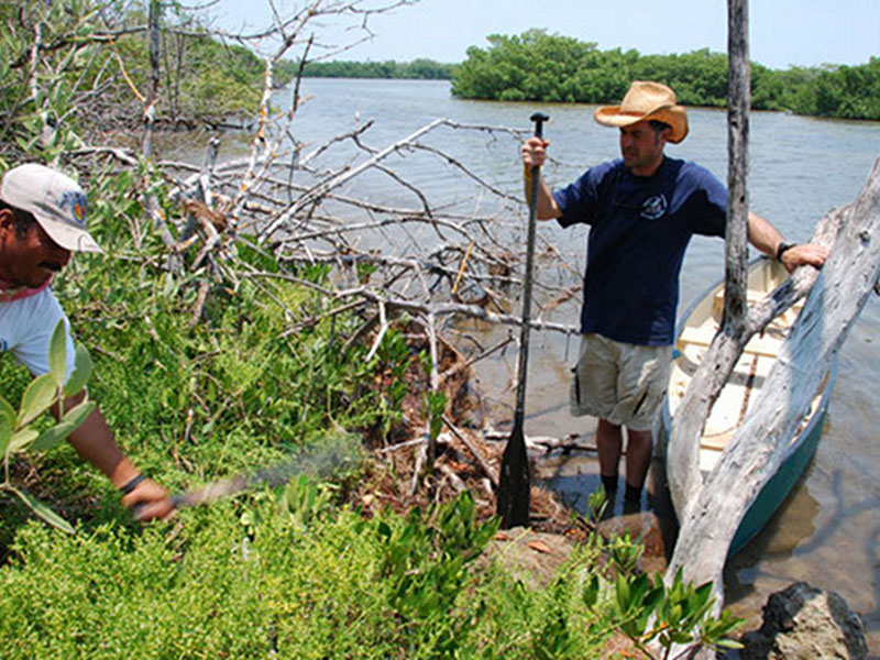
>To fully survey the island, several transects had to be cut through the jungle using machetes. Here, Dominique Rissolo marks the edge of a feature while a survey line is cleared. Image courtesy of Proyecto Costa Escondida Maritime Maya 2011 Expedition, NOAA-OER. Download larger version (jpg, 4.7 MB).
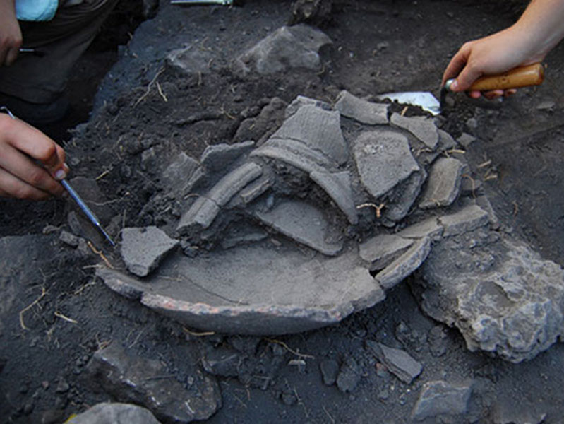
Broken pieces of pottery, or sherds, are carefully examined in one of the excavation units at Vista Alegre. Sherds were commonly found in middens and excavation units at the site. Image courtesy of Proyecto Costa Escondida Maritime Maya 2011 Expedition, NOAA-OER. Download larger version (jpg, 3.4 MB).
The topographic mapping and the mapping of the excavation locales were done with the use of an electronic total station. This is the same type of device that you would see a road survey crew using. The total station shoots a laser to a prism (which marks the point you want to map) that then bounces the laser back to the total station. Based on the horizontal and vertical angles of the total station and the speed of the laser’s return, the computer associated with the total station can do the trigonometry and calculate the location of the prism. This allows us to create a very precise (< 1 cm error) map whose overall accuracy (how closely it matches the real world) depends on our initial GPS reading (typically +/- 3 m in our study area). So, what we end up with is a very detailed map in which the relationship between points is accurate and precise, and the overall map “hovers” in space around our initial GPS point.
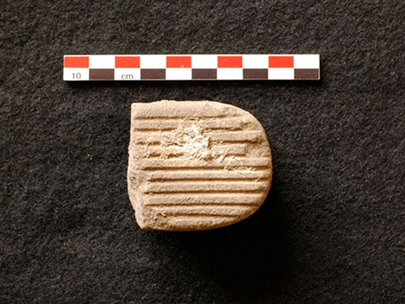
A bark beater, used by the ancient Maya to pound bark into paper, was discovered in one of the excavation units. Image courtesy of Proyecto Costa Escondida Maritime Maya 2011 Expedition, NOAA-OER. Download larger version (jpg, 2.4 MB).
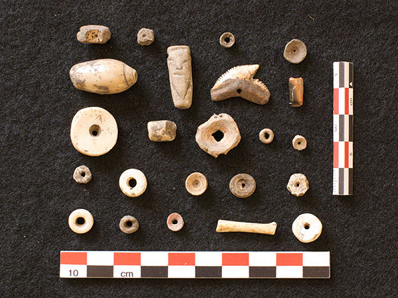
A collection of shell beads, animal bone fragments and other small artifacts found in excavations at Vista Alegre. Image courtesy of Proyecto Costa Escondida Maritime Maya 2011 Expedition, NOAA-OER. Download larger version (jpg, 2.9 MB).
Along with the total station, the key tools needed for survey in the Maya area are a sharp machete and flagging tape. We often end-up cutting transects (brechas) because the vegetation is too dense to record features across the landscape in a continuous manner and we must have a line of site between the total station and the prism (unlike a GPS unit). We ended up running two transects that ran to the water’s edge (no minor feat with all of the mangrove around the island’s margin), which further our understanding of the island’s topography and the impact changing sea levels may have had on the shape of the island.
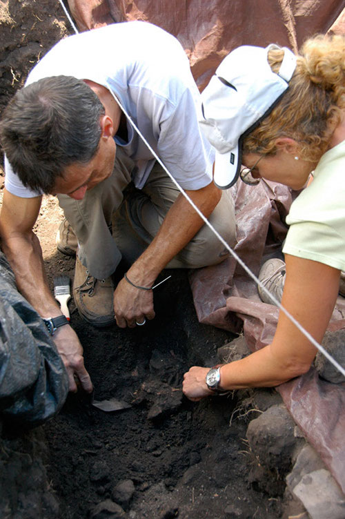
Drs. Vera Tiesler and Andrea Cucina, both bioarchaeology professors at the Autonomous University of Yucatan (UADY), examine the human remains unearthed at Vista Alegre. Image courtesy of Proyecto Costa Escondida Maritime Maya 2011 Expedition, NOAA-OER. Download larger version (jpg, 3.5 MB).
During this year’s expedition we finished one excavation unit (Unit 6) that had been started in 2008 and we opened up two new units. The new units (Units 8 and 9) were specifically placed adjacent to another unit (Unit 5) opened in 2008 in order to recover human remains. We knew these human remains were present because we had noted a femur in the northern profile of Unit 5 in 2008 after we had recovered the remains of a 3.5 – 4 year old. Now, given that archaeology is destructive and that the archaeological record is a non-renewable resource, you can’t simply dig to the depth that you want and discard all of the other cultural material. So, while our specific goal was to recover these particular human remains, in the process we were also able to recover a great deal of archaeological material related to the lives of Vista Alegre’s past inhabitants. This included a range of artifacts from the common sherd (the broken piece of a past pot or dish) to the less common bark beater shell bead, and obsidian blade (volcanic glass that is sharper than surgical steel and that was traded widely across Mesoamerica). We also recovered a great deal of information (ecofacts) relating to the diet of people. As one can imagine, living on an island lends itself to a diet rich in marine resources as evidenced by the large amounts of fish bone and shell that we recovered. In regards to the analysis of these materials, we have begun the process, but it will take the help of many colleagues and much time. A common statistic in archaeology is that 1-hour in the field results in 6 hours of lab work, and I think that is often times an underestimate of the time it takes to fully analyze the materials collected.
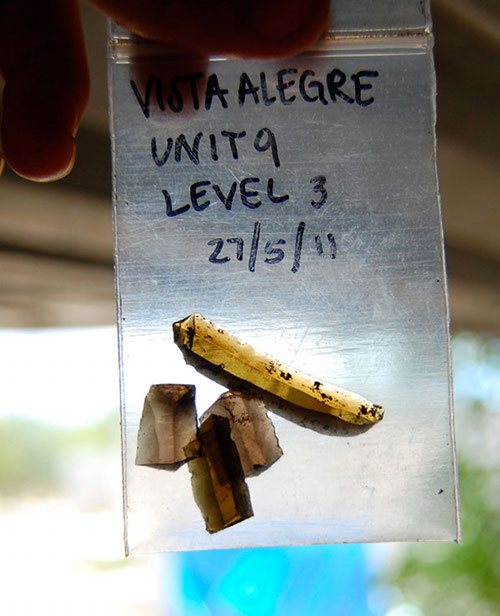
Obsidian collected from an excavation unit at Vista Alegre. Obsidian is a volcanic glass that was used for blades by the Maya and widely traded across Mesoameric. It was not found local to the Yucatan and may have come from as far away as areas near present-day Mexico City. Image courtesy of Proyecto Costa Escondida Maritime Maya 2011 Expedition, NOAA-OER. Download larger version (jpg, 1.3 MB).
Obsidian collected from an excavation unit at Vista Alegre. Obsidian is a volcanic glass that was used for blades by the Maya and widely traded across Mesoameric. It was not found local to the Yucatan and may have come from as far away as areas near present-day Mexico City. Click image for larger view and image credit.

A composite photograph of the remains discovered at Vista Alegre. The femur initially seen in 2008 was fully exposed, as was the rest of the body. However, the torso and cranium of the individual were missing. Image courtesy of Proyecto Costa Escondida Maritime Maya 2011 Expedition, NOAA-OER. Download larger version (jpg, 7.5 MB).
In regards to the human remains, we enlisted the expertise of Dr. Vera Tiesler and Dr. Andrea Cucina who are both bioarchaeology professors at the Autonomous University of Yucatan (UADY). Vera and Andrea brought their four-year old son Fabio with them to Vista Alegre, and we had a great few days in the field. We ended up exposing the femur that we had seen in 2008, and it was indeed attached to the rest of the body. As we exposed the remains, we did encounter something unexpected – the torso and cranium of this individual were missing. What we ended up determining through an examination of the profile and the adjacent unit was that people dug a pit to dispose of garbage at some point in time after the burial and in the process disturbed the burial. Basically, they must have forgotten that folks were buried here and a question of interest is what is the time difference between the burial and the intrusive pit feature. We hope to be able to address this question by studying the associated pottery and possibly through radiocarbon dates.
In addition to this one individual, we recovered the remains of three other people, bringing the total to 5 for this very small area. This was certainly not expected. The area where we are excavating is basically a combination of a midden (fancy archaeo-speak for a trash deposit) and fill, intentionally deposited material used to build-up and level the margins of the island. Typically individuals were buried under house floors in Mesoamerica. So, this seeming concentration raises a number of questions – were all these individuals deposited at the same time (i.e., did these folks all die at the same time)? They are all roughly at the same depth, which would suggest contemporaneity, but they are not laid-out in a regular fashion such as one would expect in a cemetery. With the help of Vera and Andrea we hope to be able sort out this mystery, although we won’t be able to do it in an hour segment la C.S.I. We do, however, look forward to trying to unravel the depositional history of this area and how the burials fit into the broader history of the island.