By Chris Goldfinger - Marine Geologist/Geophysicist - Oregon State University, Marine Geology Active Tectonics Group
One of the key species we are studying in this project is Lophelia pertusa. L. pertusa is a stony coral that occurs throughout the world’s oceans mostly at depths from 200 – 1000 meters, yet in the Gulf of Mexico L. pertusa has been observed to a maximum depth of 650 meters. L. pertusa, like most reef-building corals corals, forms colonies that provide habitat for numerous fishes and invertebrates. The functional unit of each coral colony is the polyp, and all polyps are connected to each other by a thin layer of tissues called the coenosarc.

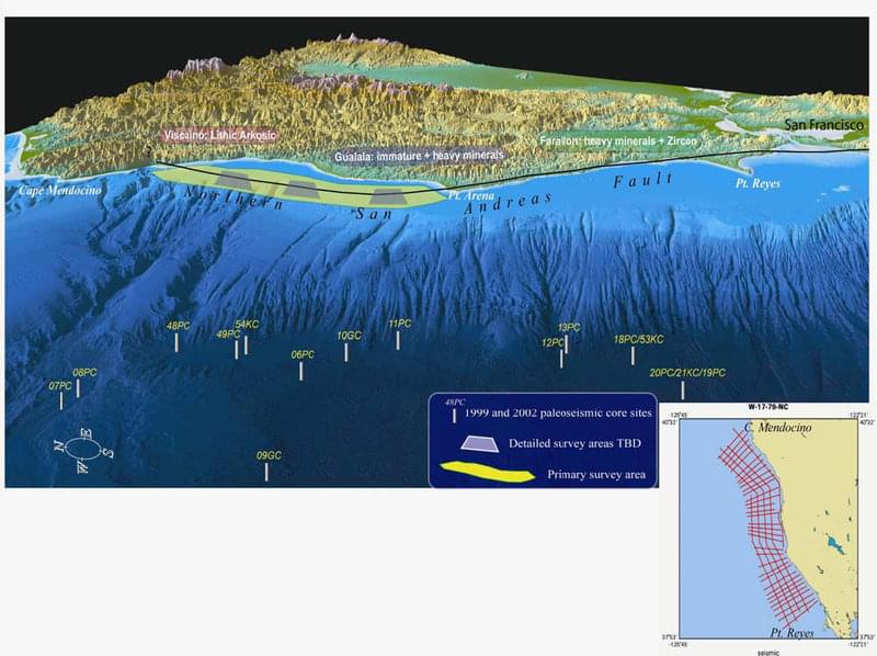
Northern San Andreas Fault proposed exploration site and approximate survey areas, including existing paleoseismic core locations. Image courtesy of San Andreas Fault 2010 Expedition, NOAA-OER. Download image (jpg, 152 KB).
During re-charge periods for the AUV, multi-frequency sonar water column transects will be acquired to image fish distributions as well as gas venting along the fault. We will use the port of Fort Bragg for staging vehicles and personnel as needed during both legs. The best weather window is late Sept. and Oct. when fog and wind are at a minimum. One of the reasons the San Andreas is not well know offshore is perennial bad weather. The Exploration site is generally inshore of a perennial high wind region offshore as it is in the lee of Cape Mendocino for the most part, however the weather window is fairly narrow. Following the cruise, we will hold a workshop at the Fall AGU meeting in San Francisco to explore the mapping data and plan detailed strategy for data integration and publication.
The analysis will consist of integrating the seismic profiles, multibeam sonar mapping and backscatter data, and existing regional multichannel seismic reflection data to develop a tectonic model for the NSAF. Numerous first order questions about this fault remain unanswered, in addition to the earthquake history. These include how the fault accommodates a 30 degree right bend, on the northern California shelf, and how the fault is seismically segmented. Song et al. (2008) demonstrated that the 1906 rupture had two distinct segments, yet nothing is known about these and what they relate to structurally. We will work closely with Carol Prentice of the USGS Earthquake Hazards team to integrate the land and marine data. Recent LIDAR coverage has revealed great details of the fault onshore, and now the marine side will be integrated with these new land data. Our long-term paleoseismic work offshore provides a framework of earthquake histories and segmentation along the NSAF, and ultimately, we hope to be able to understand how the fault segments tie into the earthquake history, a critical piece of the puzzle when it comes to earthquake hazards in San Francisco and northern California. Habitat related data will be integrated into the regional Essential Fish Habitat mapping that is used by the Pacific Fisheries Management Council to establish commercial fishing regulations. Beyond that, the AUV transect data ill be used to assess species distributions in the study area and relate them to their associated benthic habitats.