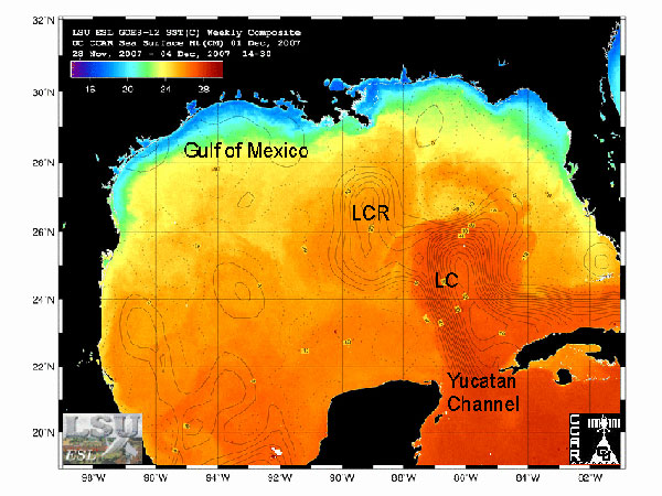
Figure 3. Sea surface height contours overlaid on a weekly composite sea-surface temperature image (captured via satellite) of the Gulf of Mexico. Warm water currents (shown in darker oranges and reds) such as the Loop Current (LC) and LC rings (LCR) are easily determined with sea surface temperature and sea surface height data. Higher sea surface levels are generally associated with subsurface heat, and are thus useful in identifying currents when the sea surface is isothermal (similar in temperature). Image courtesy of LSU's Earth Scan Laboratory.
NOTICE: This page is being retained for reference purposes only and is no longer being updated or maintained.


