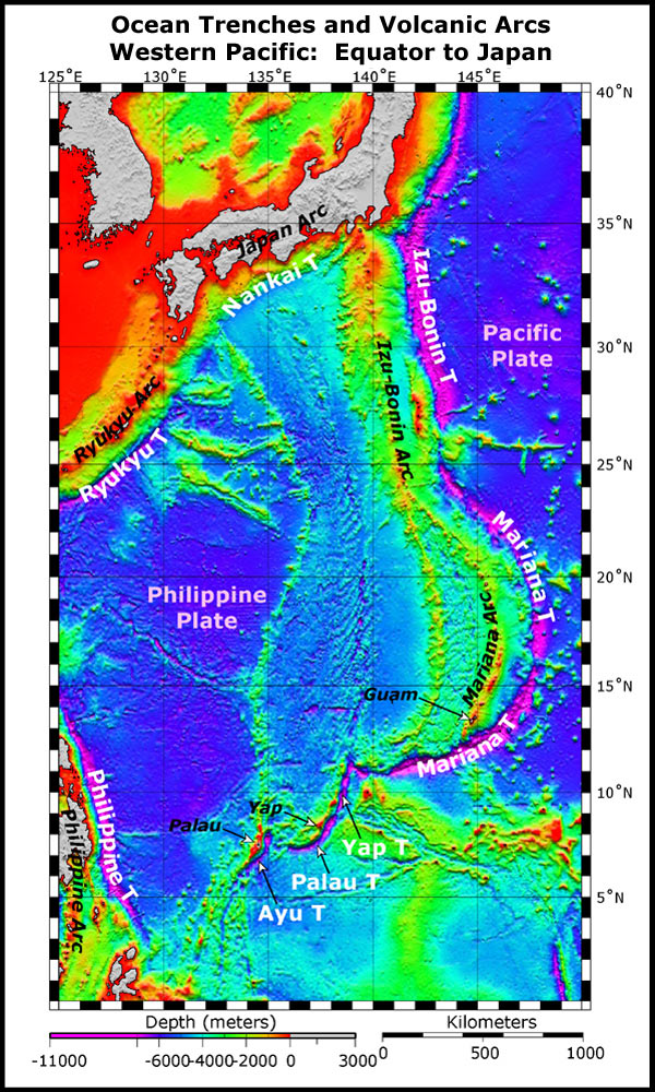
This image presents satellite altimetry data of the western Pacific from the equator to Japan. Submarine trenches are indicated with white text over magenta; volcanic arcs are indicated by italicized text. In the western Pacific, the volcanic arcs (island and submarine) are west of the trenches, due to the western migration and subduction of the Pacific plate under the Philippine plate. Volcanic arcs form when the subducting plate melts at depth and magma (fluid that cools to form igneous rock) is produced, which rises bouyantly and forms volcanic arc lavas. Satellite data courtesy of Smith and Sandwell, 1997. Image courtesy of the NOAA Vents Program.
NOTICE: This page is being retained for reference purposes only and is no longer being updated or maintained.


