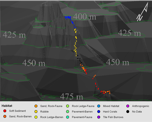
Figure 3. Example of a three-dimensional depiction of changes in habitat over the course of a single submersible dive track. As we gather more detailed bottom contour data, our maps will show increasing details. This, matched with the first hand view provided by the submersible, is a powerful way to describe the sea floor. Image courtesy of Ross et al., NOAA-OE, HBOI.
Related Links
Life on the Edge 2005: Oct 19 Log


