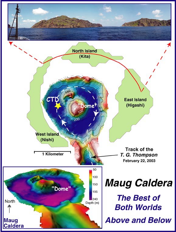
The bathymetry map in the center of the image shows the location of the CTD cast in the Maug caldera. The white dashed line indicates the trackline of the Thompson. In the lower left corner is a three-dimensional image of the submerged caldera. The data were gridded at 15 meters with no vertical exaggeration. The top of the figure shows a panorama of the islands of Maug. From left to right one can see the northern corner of Nishi, all of Kita, and the majority of Higashi.
NOTICE: This page is being retained for reference purposes only and is no longer being updated or maintained.


