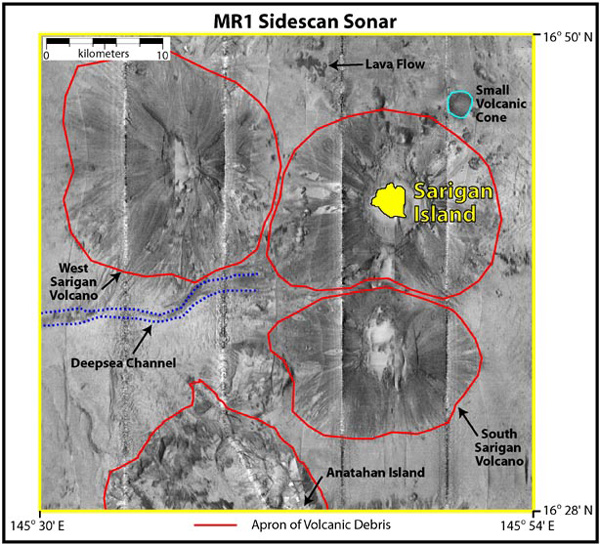
Mosaic of four sections of MR1 survey lines around Sarigan Island. The four evenly spaced north-south lines indicate the tracklines directly beneath the center of the ship, called nadir. The sidescan resolution is 16 meters.
NOTICE: This page is being retained for reference purposes only and is no longer being updated or maintained.


