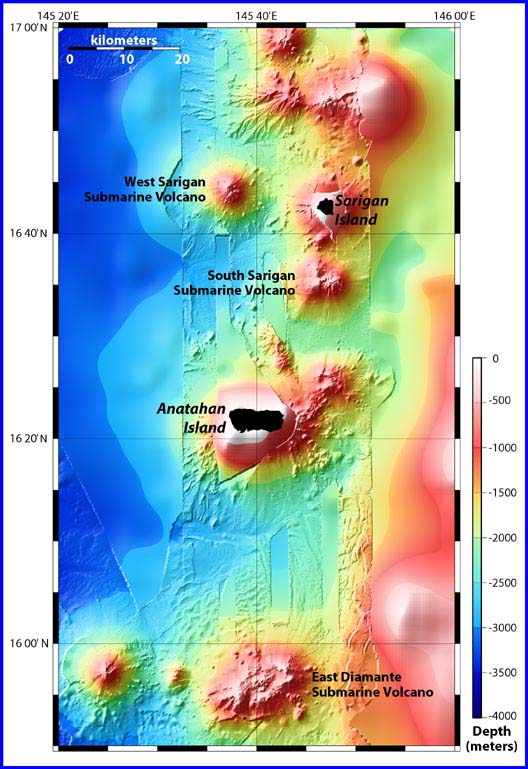
Location map showing East Diamante and Sarigan submarine volcanoes, as well as the volcanic islands of Sarigan and Anatahan. The bathymetry data are a combination of satellite bathymetry overlaid with EM300 multibeam bathymetry, which was collected on the present cruise. Note the differences.
NOTICE: This page is being retained for reference purposes only and is no longer being updated or maintained.


