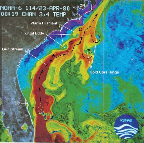
Sea surface temperature readings can be used to identify thermal fronts where fish often congregate. Scientists onboard are using GIS to identify these locations for the billfish satellite tagging program.
Related Links
Investigating the Charleston Bump Exploration


