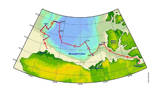
The red line indicates the projected cruise path for the CCGS Louis St. Laurier. The blue dots with circles around them depict the areas projected to include ROV operations. Image courtesy of Arctic Exploration 2002, NOAA/OER.
NOTICE: This page is being retained for reference purposes only and is no longer being updated or maintained.


