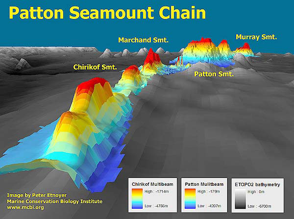
High resolution Seabeam bathymetry (in color) derived from the Atlantis shipboard echosounder is overlayed upon lower resolution ETOPO2 satellite derived bathymetry (gray tones). Image courtesy of Exploring Alaska's Seamounts 2002, NOAA/OER.
NOTICE: This page is being retained for reference purposes only and is no longer being updated or maintained.


