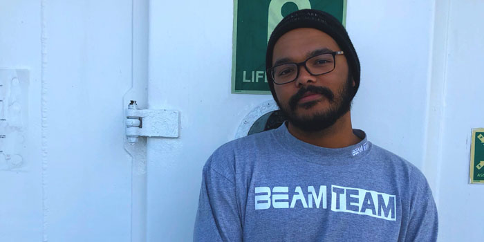
Meet Treyson Gillespie
Read the full text of Treyson's interview below to learn more about his experiences.
About Treyson's Role
What were your duties as an Explorer-in-Training?
I joined the Explorer-in-Training program as an on-shore mapping intern at the CCOM/JHC command center at the University of New Hampshire (UNH). My duties included pulling data uploaded by the ship from servers throughout the day, and processing that data through various software. Taking the multibeam, split-beam, and sub-bottom raw data, we used Qimera, Fledermaus Midwater, and SEGyJp2 softwares to clean, edit, and create usable surfaces for scientific analysis. The data is then exported to a database where anyone can download and use the files for their specific pursuits.
In addition to the processing, we performed various data management tasks, such as keeping logs, recording any errors or abnormalities in the data, and connecting via telepresence to run the sonars remotely.
Which school are you attending?
I’m currently in the final year of my degree in Geology & Environmental Geosciences with a concentration in Coastal Geology and Ocean Mapping at the College of Charleston in Charleston, SC.
Where was your work experience located? If you were working at sea, what were your impressions of living and working on a ship?
The command center was located on the UNH campus at the Center for Coastal and Ocean Mapping/NOAA Joint Hydrographic Center in Durham, NH.
What sparked your initial interest in ocean sciences?
I grew up in and around farms in the upstate of South Carolina, completely landlocked and only getting to see the ocean once or twice a year. This didn’t stop me from doing any and everything I could to be in the water, either boating on lakes or swimming in local pools. My parents used to joke that I was half-fish. Eventually that love for the water pushed me to pursue marine biology as a major, but after an incredible research abroad opportunity my freshman year, I realized that marine geology was more my speed.
On that research trip I met Dr. Leslie “Doc” Sautter, who would eventually become my advisor and good friend. She introduced me to a new world while explaining the geology of the area. She explained the different applications of marine geology and eventually seafloor mapping and I was hooked. I immediately enrolled in her marine geology class and knew that this was what I wanted to do. I then went on to become a part of the BEnthic Acoustic Mapping & Survey program (BEAMS) and proceeded to take other classes offered by Doc.
Through those classes, I found that we know so little about an entity that covers more than 70% of our home and that both excites and frustrates me. Ocean exploration and science offers an opportunity to uncover and help build a usable knowledge base for understanding our oceans, and ultimately more about the rock we’re hurtling through space on.
What was the most personally rewarding part of your experience?
The most rewarding aspect of this experience was definitely gaining the confidence to do exploratory mapping. I’ve wanted to work in ocean exploration for a while now, but without any true exploratory experience I was worried, like most undergrads, that I wouldn’t do well. That obviously wasn’t the case, and I’ve learned so much over the last two and a half weeks about this awesome career path. My time here has been incredible and I owe a lot of that to the awesome team of interns I worked with and to the incredible mentors at OER who were always willing to answer questions. This has been an incredibly rewarding experience and because of that I can’t wait to get out on the Okeanos Explorer in the coming years.
Please describe your final project.
For my final project on this cruise, I was tasked with creating two video fly-throughs of our processed data. One video was a general overview of several survey areas, while the second was of an interesting and unidentified feature found on the seafloor. While mapping, the survey teams on shore and onboard the vessel noticed a huge zig-zag feature, with several almost right angle turns in the backscatter. We immediately sent screenshots of it to several different scientists and are working on figuring out what it is. It was definitely one of the neatest finds on this survey!
How do you see this experience fitting in with your future career plans?
As I want to go into the field of hydrography and seafloor mapping, this experience helped me to gain insight into the actual operations of an exploratory mapping cruise. Exploration has always been a part of this industry that I’ve been fascinated with and to learn the ins and outs of exploratory data collection and processing was such a neat experience. Having this time at UNH will make me that much better at operations, processing, and trouble shooting any problems that may occur while I’m out at sea or on shore.